WASHINGTON — WEATHER HEADLINES
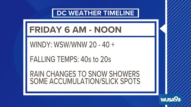
- Rain and showers will change to snow and snow showers Friday morning as temps plummet from the 40s to the 20s by noon.
- Any wet roads/ponding/puddles will flash freeze
- Gusty wind may lead to isolated damage and power outages
- Christmas weekend will be very cold, with highs in the 20s and lows in the teens and single digits.
By now, you know that we are in for some winter weather to kick off the Christmas holiday weekend. Here's your detailed timeline of what to expect.
FRIDAY
A potent Arctic cold front comes in. This will give us another shot at a few flakes and set us up for a very cold holiday weekend.
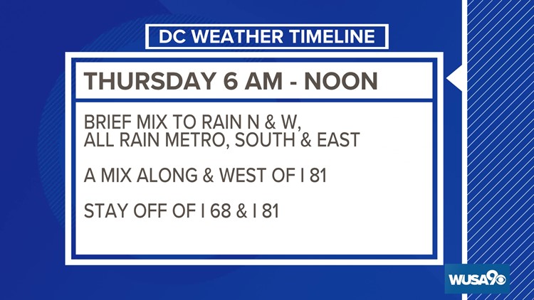
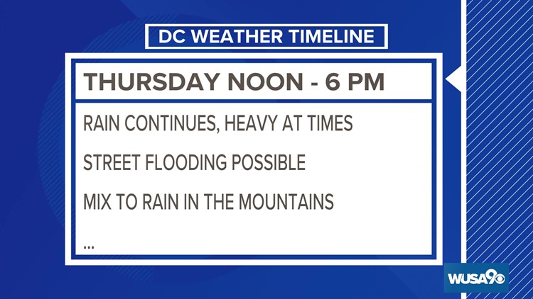
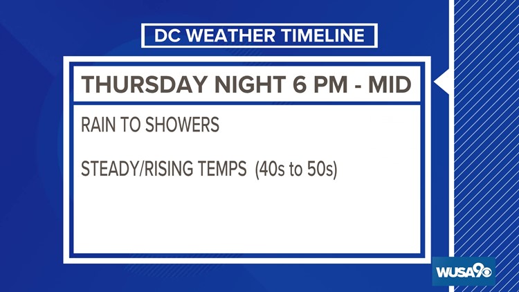
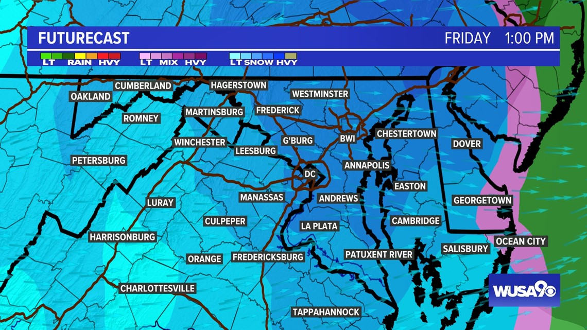
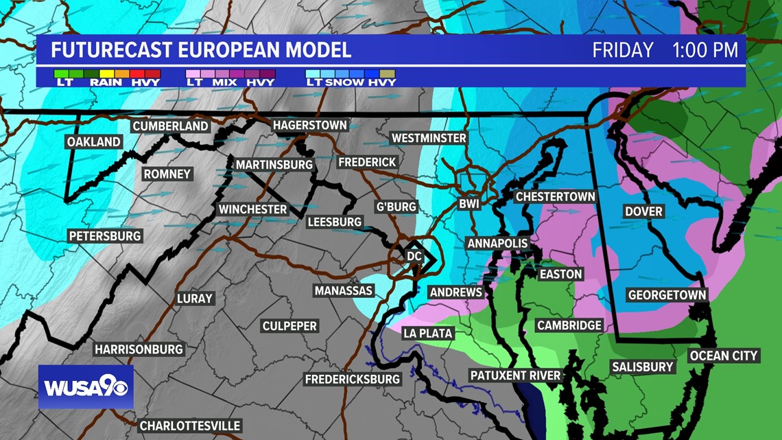
Friday will start with rain showers for most areas. As the cold air comes through, temperatures will drop sharply. We could see temperature drops of as much as 10 to 15 degrees in an hour.
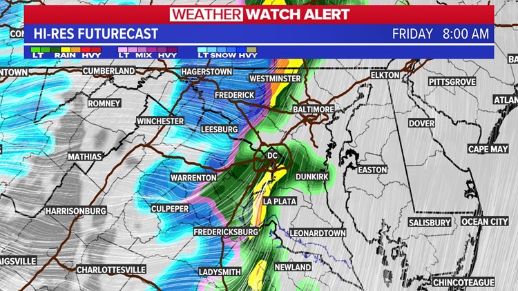
The Arctic front will squeeze all the moisture out of the atmosphere changing showers to snow showers. The best place for this to happen will be over the mountains and in Western Maryland. For D.C. Metro, plan on a brief period of snow showers with little or no accumulation.
In Western Maryland and West Virginia, places like Cumberland, Hagerstown, and Frederick, there will be snow accumulations. The snow is great news for the ski resorts.
Here's a look at the timeline for the upcoming storm


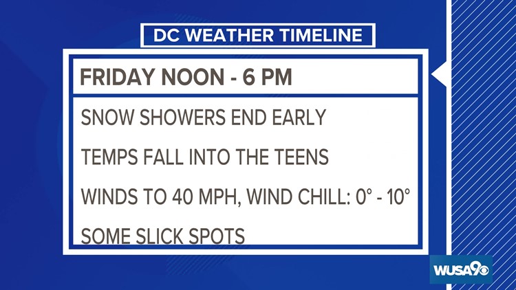
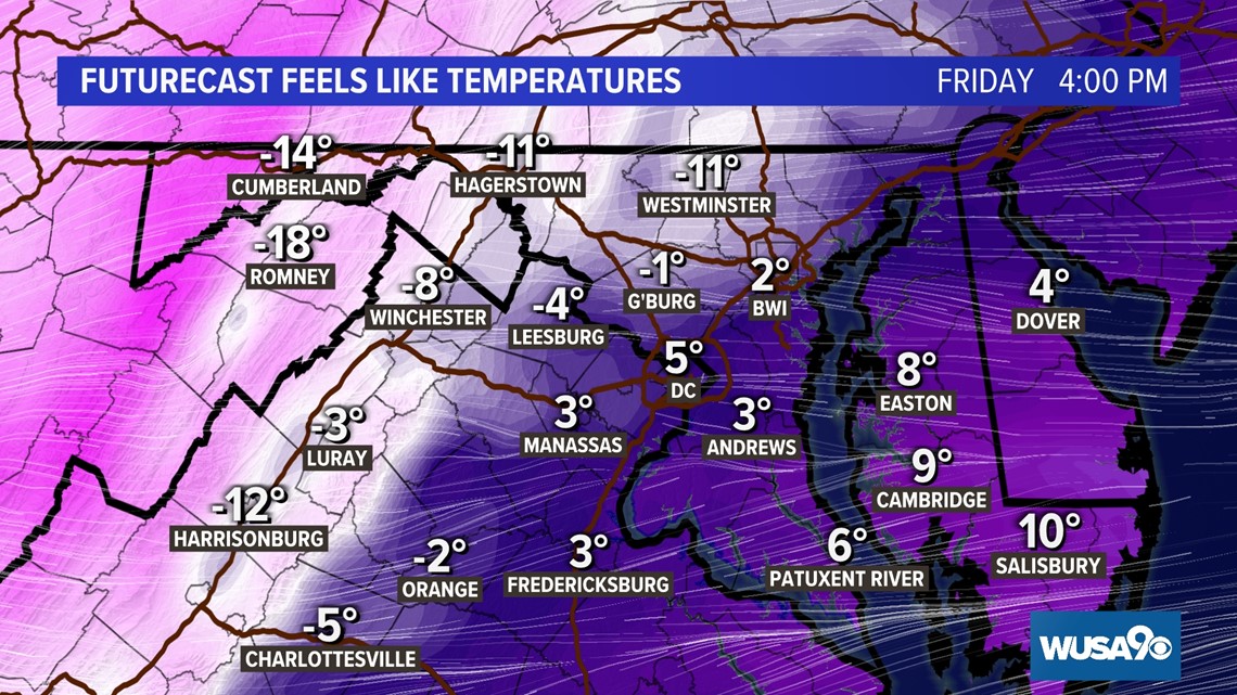
A cold blast is on the way. Get ready for temperatures to take a very big dip heading into the holiday weekend. Highs will only be in the 20s in most areas with overnight lows in the teens. Downtown could remain below freezing for 118 consecutive hours beginning around 12 p.m. Friday. If you have not already, it's time to bring the hoses inside and drain your outside spigots.
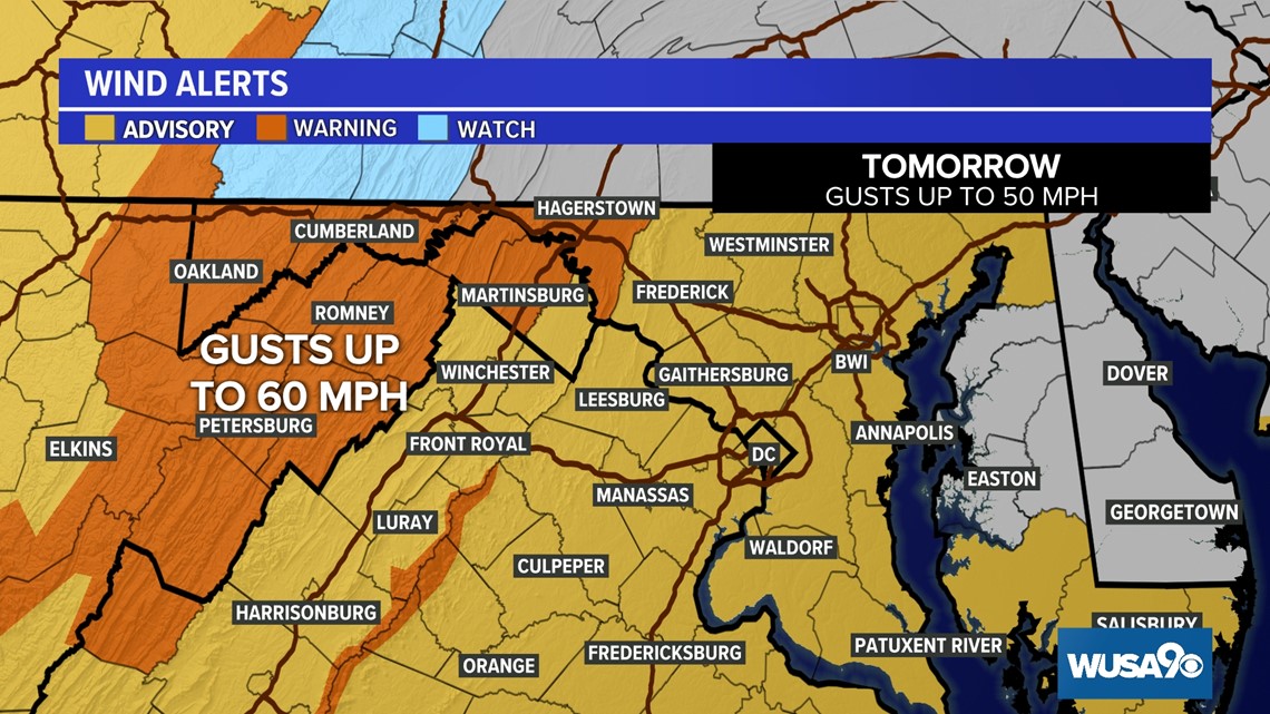
A Wind Advisory has been issued for most of the DMV for winds gusting up to 50 mph. A High Wind Warning has been issued for our far northwestern counties and parts of the Shenandoah where winds could gust up to 60 mph.

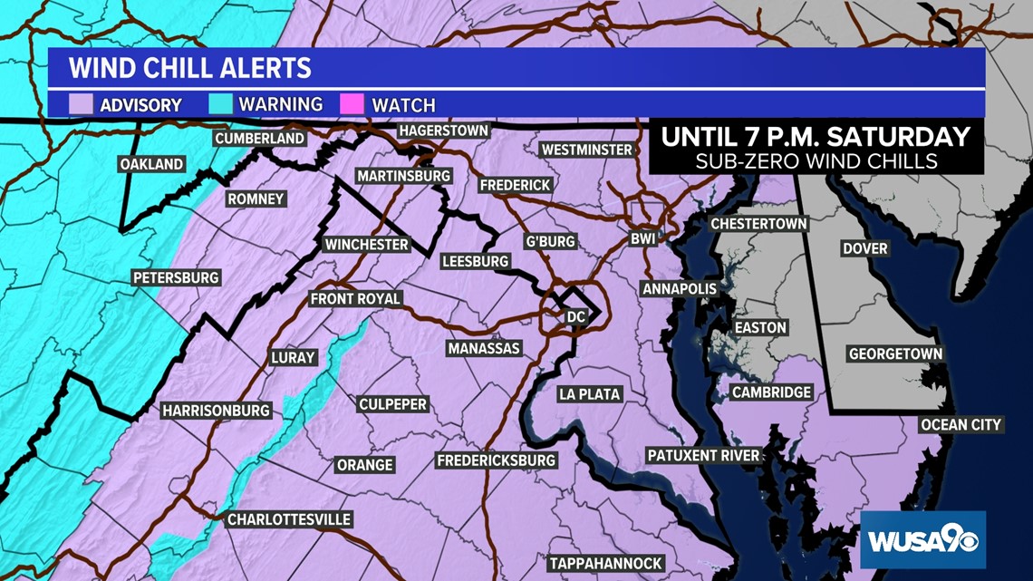
A Wind Chill Advisory has also been issued for most of the DMV for wind chills in the single digits and sub zero. Areas under a Wind Chill Warning could experience "feels-like" temperatures 45 degrees below zero.


GFS FRIDAY

EURO FRIDAY

KEY TAKEAWAYS
1) Rain Friday with a slight chance for it to change to snow. Little to no accumulation for D.C. Metro.
2) Any minor accumulation/leftover moisture could flash freeze as temperatures plummet.
3) Very gusty wind could lead to power outages.
4) If you are traveling to the Midwest (Chicago, Detroit or Milwaukee) try and arrive by Wednesday. Blizzard conditions will grip the Great Lakes Thursday night and Friday with winds over 60 mph.
Check back here for updates to this forecast throughout the week.