
WASHINGTON — Temperatures will start in the cold 20s across the DMV Friday morning.
Three Things To Know:
- Chilly but dry through Saturday
- Sunday will be mainly dry until showers arrive during the second half of the day
- Tracking rain Monday, Tuesday and Thursday next week
Forecast:
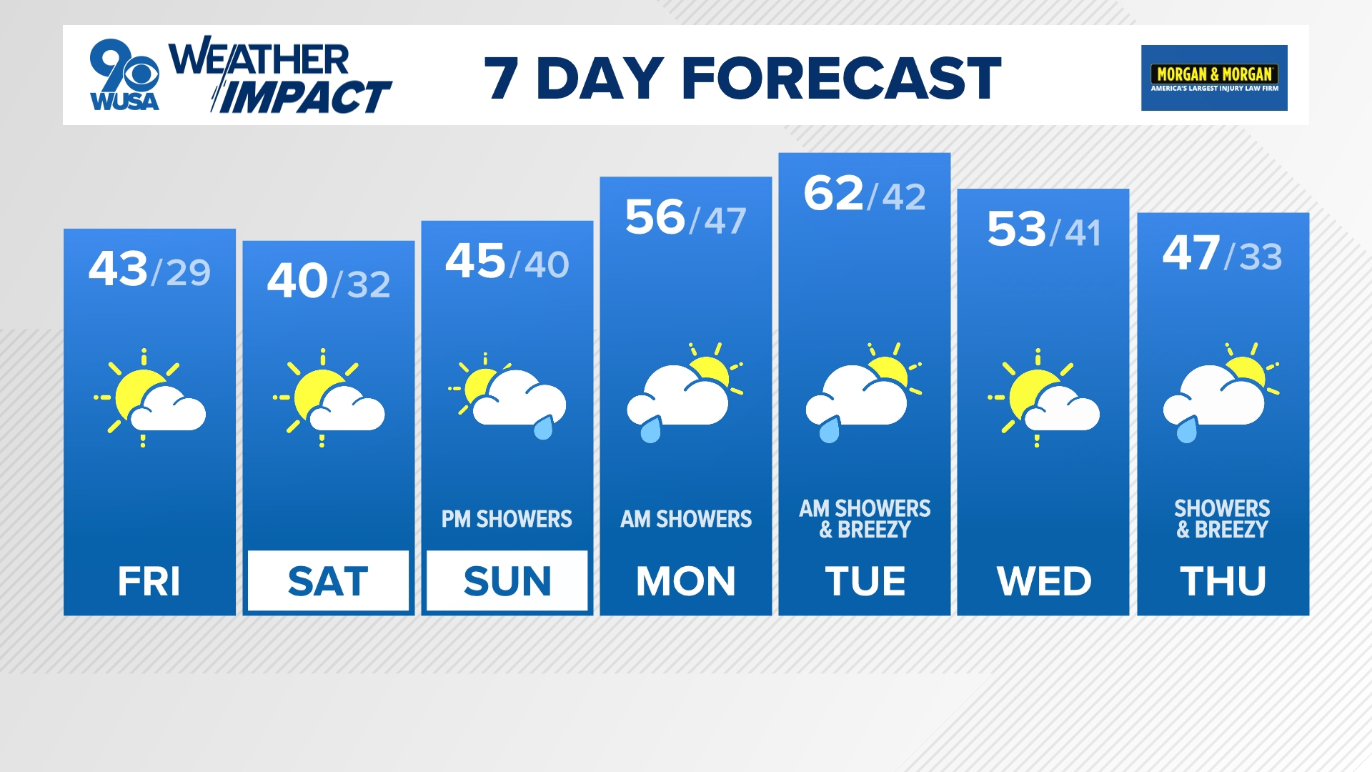
Friday: Cold with increasing afternoon clouds. Highs: 37 - 42. Winds: Light.
Friday Night: Partly cloudy and cold. Lows: 20 - 29. Winds: Light.
Saturday: Partly to mostly sunny and cold. Highs: 38 - 43. Winds: E 5.
Weather Conversation:
Although it'll be mostly sunny, dress for a cold start Friday morning. Temperatures will be well below freezing in most neighborhoods.
Throughout the day on Friday, clouds will move into the DMV and it will be another chilly day with high temperatures in the upper 30s and low 40s.
The weekend will start off bright but chilly with sunny skies Saturday and high temperatures in the upper 30s and low 40s. By Sunday, clouds will begin to increase and showers will arrive later at night. With a cold air damming set up, there is potential for some snow and ice along the I-81 corridor. Temperatures will be cool once again around the mid 40s.
Weather Impacts:
Kids will need a heavy jacket, hats, gloves and even a scarves at the bus stop Friday morning with at least a heavy jacket Friday afternoon.
What We're Watching:
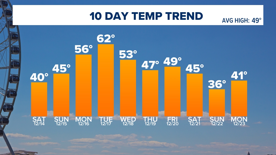
Multiple rounds of rain will impact the DMV Monday, Tuesday and Thursday of next week.
RELATED: Record warm November and Fall
7 DAY


10 DAY

MORE WAYS TO GET WUSA9
DOWNLOAD THE WUSA9 APP
Apple App Store: WUSA9 News on Apple
Google Play Store: WUSA9 News on Android
HOW TO ADD THE FREE WUSA9+ APP TO YOUR STREAMING DEVICE
ROKU: add the channel from the ROKU store or by searching for WUSA9.
For both Apple TV and Fire TV, search for "WUSA9" to find the free app to add to your account. Another option for Fire TV is to have the app delivered directly to your Fire TV through Amazon.