WASHINGTON — Keep an umbrella handy for Thursday into Friday. The WUSA9 Weather Watch team is monitoring a storm system that will bring rain, wind and even a few strong thunderstorms, especially later in the afternoon and evening.
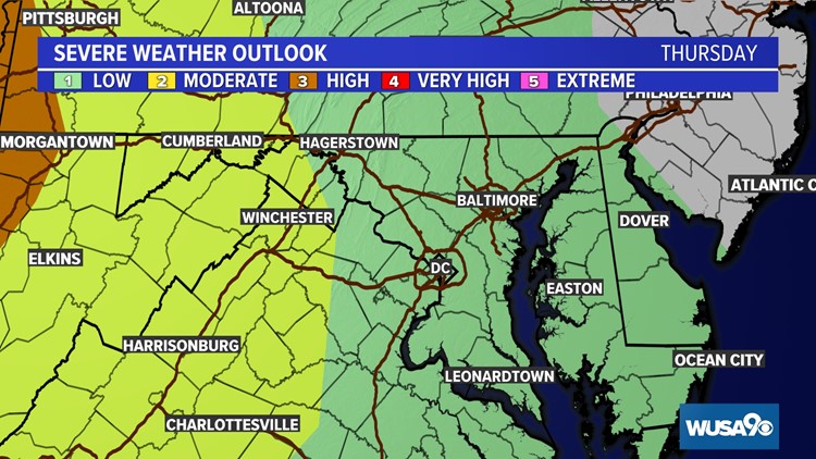
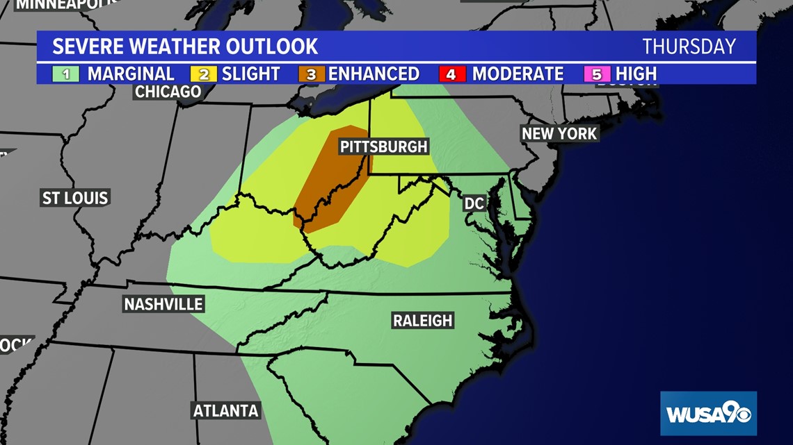
There is a small risk for severe storms with damaging wind being the primary threat. On a scale of 1 to 5, this is a level 1 threat.
There is also a low risk for an isolated tornado. The higher risk remains well to our west through the Ohio River Valley. If any rotating storms were to develop across the DMV, it would be later in the evening after 6 p.m. through around midnight.


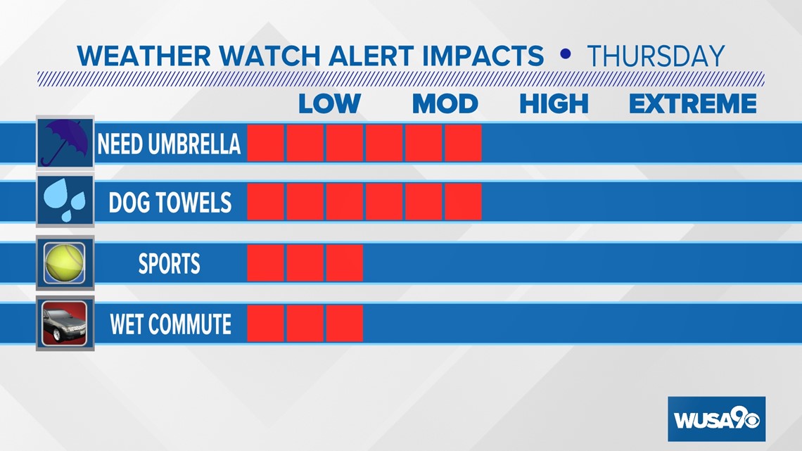
Winds associated with the storms could still be strong enough to snap a few weak trees and limbs. Gusty winds may also cause some isolated power outages. The rain and wind will also likely lead to altered outdoor plans.
Key Points:
- Critical timing for travel-impacting rain is now - Friday 2 a.m.
- Critical timing for isolated storms with potential damaging winds Thursday 9 p.m. - Midnight Thursday night
- Generally, winds will range between 15 and 25 mph +, with gusts in excess of 58 mph in strong to severe storms
- Main spin-up tornado risk mainly west of DMV
- Minor coastal flooding at the time of high tide on the Potomac River and Chesapeake Bay


Timeline:
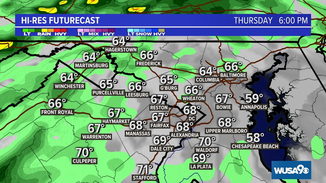
Thursday 6 p.m.
On-and-off rain will continue through the immediate DC Metro during the afternoon commute, although the worst weather will move through after sunset. It's during this time there may be damaging winds, brief downpours, and perhaps even a spin-up tornado, especially west of the District.

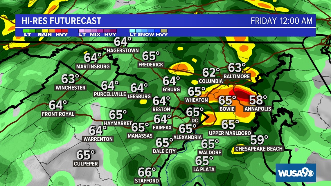
Midnight Thursday Night
Though severe weather should generally have waned, additional showers along with an embedded thunderstorm are possible through midnight Thursday night into the wee hours of Friday morning.

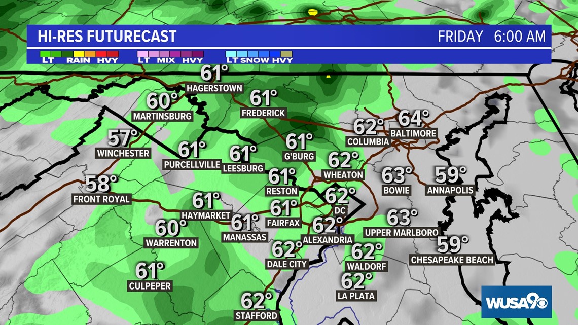
Friday Morning
Most showers of significance should have already waned by Friday morning, although some leftover wet roads are still possible for the morning commute.

By the time the majority of the rain tapers, up to about a quarter to half an inch will have fallen, with some spots picking up between a half and one inch of rain.


RELATED: How to prepare for severe weather
Do you have a news tip on this story or any other story? We want to hear from you. Tell us about it by emailing newstips@wusa9.com.
MORE WAYS TO GET WUSA9
DOWNLOAD THE WUSA9 APP
Apple App Store: WUSA9 News on Apple
Google Play Store: WUSA9 News on Android
HOW TO ADD THE FREE WUSA9+ APP TO YOUR STREAMING DEVICE
ROKU: add the channel from the ROKU store or by searching for WUSA9.
For both Apple TV and Fire TV, search for "WUSA9" to find the free app to add to your account. Another option for Fire TV is to have the app delivered directly to your Fire TV through Amazon.
SIGN UP TO RECEIVE WUSA9 NEWSLETTER
Subscribe to our daily WUSA9 Newsletter for top stories from WUSA9 curated daily just for you. Get content and information right now for can’t-miss stories, Commanders content, weather, and more delivered right to your inbox.