
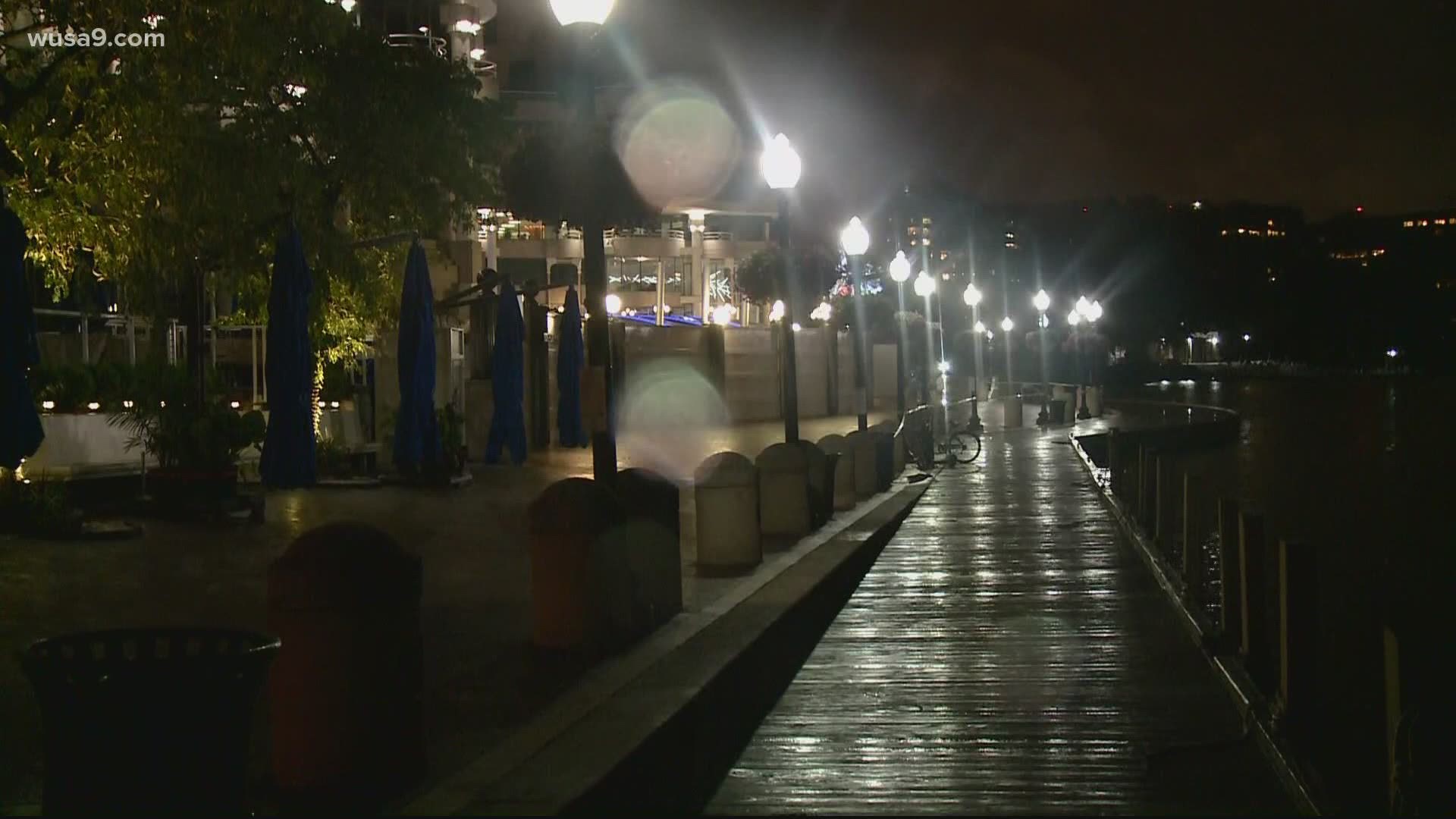
WASHINGTON — A Tropical Storm Warning and Flood Watch are in effect for the majority of D.C., Maryland, and Virginia region as Tropical Storm Isaias makes its way up the east coast.
Whether the floods hit your area this time around or not, you might be wondering, how likely is the next storm to put me in the flood zone.
Using data from FEMA and Open Data DC, we mapped out the estimated flooding risks across the District of Columbia. Use the map below to explore data for your area (find detailed definitions after the map):
By default, the map shows basic flood areas and the roads and bridges most likely to flood (in orange). Use the layer selector to see additional data for Storm Surge Risk and Special Flood Hazard areas.
Here is a list of other flood-prone areas across the DMV area:
PRINCE GEORGE'S COUNTY
- Brock Bridge Road near Laurel-Bowie Road (RT 197) Laurel
- Areas along Route 1 and Main Street in Laurel
- Baltimore Ave and Ammendale Road in Beltsville
- Sunnyside Avenue between Rhode Island Ave and Edmonston Rd in Beltsville
- Piney Branch Rd and New Hampshire in Adelphi
- Portions of Riverdale Road in Riverdale Park
- Governors Bridge Road at Anne Arundel/Prince George's County border.
- Water Street in Upper Marlboro
- Marlboro Pike and Largo Rd in Upper Marlboro
- Livingston Road and Oxon Hill Road in Ft Washington
- Livingston Road and Palmer Road in Fort Washington
MONTGOMERY COUNTY
Down-County Areas
- MD 29 (Columbia Pike) at Paint Branch - N. of White Oak
- MD 185 (Conn. Ave) at Rock Creek - S. of Kensington
- MD 190 (River Road) at Cabin John Creek - Potomac
- MD 193 (Univ. Blvd) at Sligo Creek - Wheaton
- MD 586 (Viers Mill Rd) at Rock Creek - S. of Twinbrook Pkwy.
- Beach Drive in Rock Creek Park - Kensington-Chevy Chase
- Sligo Creek Pkwy - Silver Spring-Takoma Park
Up-County Areas
- MD 97 (Georgia Ave) at Reddy Branch - N. of Brookeville
- MD 124 (Woodfield Rd) at Goshen Branch and at Gr. Seneca Creek - N. of Brink Rd.
- MD 117 (Clopper Rd) at Gr. Seneca Creek - W. of Gaithersburg
- MD 117 (Clopper Rd) at Little Seneca Creek - E. of Boyds
- MD 355 (Frederick Rd) at Little Seneca Creek - W. of Brink
- MD 121 (Clarksburg Rd) near Little Seneca Lake - N. of Boyds
- MD 118 (Germantown Rd) at Great Seneca Creek - S. of Germantown
- River Rd and Berryville Rd at Seneca Creek
- Blunt Road at Great Seneca Creek - S. of Brink Rd.
- Davis Mill Rd at Great Seneca Creek - N. of Gaithersburg
- Brighton Dam Rd at Hawlings River - NE of Brookeville
- Goldmine Rd at Hawlings River - E of Olney
- Zion Rd at Hawlings River - E. of Laytonsville
- Hoyles Mill Rd at ford of Little Seneca Creek - Germantown
- Loghouse Rd at Magruder Branch - S. of Damascus
- Elton Farm Rd at Haights Branch - N. of Sunshine
- Howard Chapel Rd at Haights Branch - N. of Sunshine
- White’s Ferry Road and River Road - White’s Ferry
Note: This is not a full list of flood-prone places across the D.C. Metro area. This list will be updated as more information becomes available.
––––––––––––––––––
DEFINITIONS
- High-Risk Area – Areas corresponding to the 100-year floodplain and most likely to flood (equal to or better than a 1-in-100 chance in a given year). Homeowners in these areas are federally required to purchase flood insurance.
- 0.2% Annual Chance Flood Hazard – The so-called 500-year floodplain. These areas have a one-in-500 chance of being flooded in a given year. Homeowners in these areas not required to purchase flood insurance.
- Area of Minimal Flood Hazard – Areas outside of the 500-year floodplain. Floods here are very uncommon.
- Area with Reduced Flood Risk Due to Levee – Areas that would be within the 100-year floodplain area, but which are protected by a levee. Flood insurance requirements may vary.
- Roads/Bridges Most Likely to Flood (shown in orange) – Structures determined to be especially vulnerable to flooding during heavy rains.
- Floodway – Areas adjacent to a body of water reserved to help channel floodwaters. Floodways necessarily have high flood risks.
- Storm Surge Risk Areas – Areas vulnerable to flooding during a storm surge (i.e. a hurricane or tropical storm). These areas may be evacuation zones during extreme weather events.
- Special Flood Hazard Area – Area designated by FEMA as having a special flood, mudflow or erosion hazard. These areas have a high risk of flooding and homeowners are therefore required to purchase flood insurance.
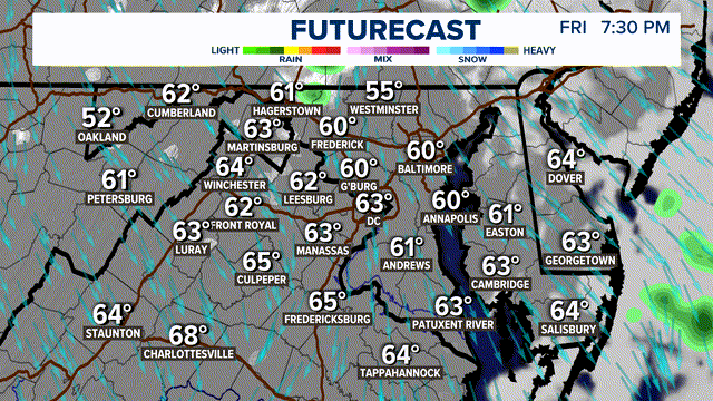
This track offshore would not require mass evacuations from East Coast beaches, although Gov. Ralph Northam did declare a state of emergency for Virginia.