
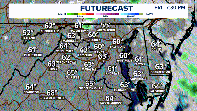
WASHINGTON — A few showers & storms will impact parts of DC, Maryland and Virginia Tuesday evening as a front remains stalled just north of our area.
OVERVIEW:
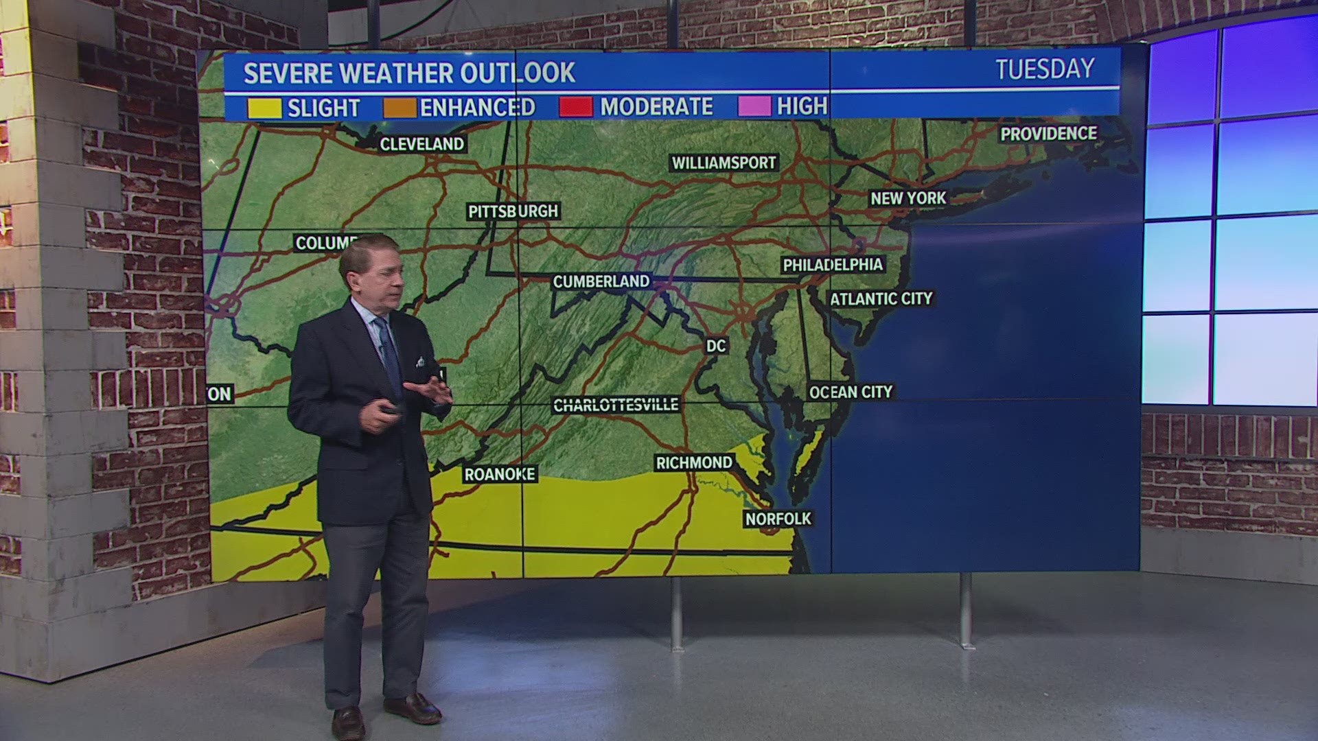
Tuesday is a day that you want to constantly monitor the weather. Strong to severe storms are possible Tuesday evening in D.C., Maryland, Virginia and West Virginia.
After the mid-day round of showers, clouds have been gradually clearing and thinning throughout the afternoon. A few showers and storms develop and move into the area this evening through midnight. But because of the timing of how long it takes sunshine to appear, our severe threat will stay low, but is not zero percent. Storms could bring locally heavy rain. An isolated storm could turn strong/severe with gusty winds.
TIMELINE:
Now to 6 p.m.: Partly sunny skies re-emerge. We'll track some developing showers and storms near I-81 and the Shenandoah Valley.


6 p.m. to 9 p.m.: Some downpours and storms continue tracking eastward closer and then across the I-95 corridor. Some could be heavy/strong. An isolated severe storm is possible with damaging winds. The best chance of a severe storm is south of I-66.


9 p.m. to Midnight.: A few showers/storms continue -- some could be heavy. Overall storm coverage wanes after midnight. Intensity decreases as we go later overnight.

