
WASHINGTON — Scientists are working to figure out what happened after Hurricane Otis unexpectedly turned from mild to explosive in record time.
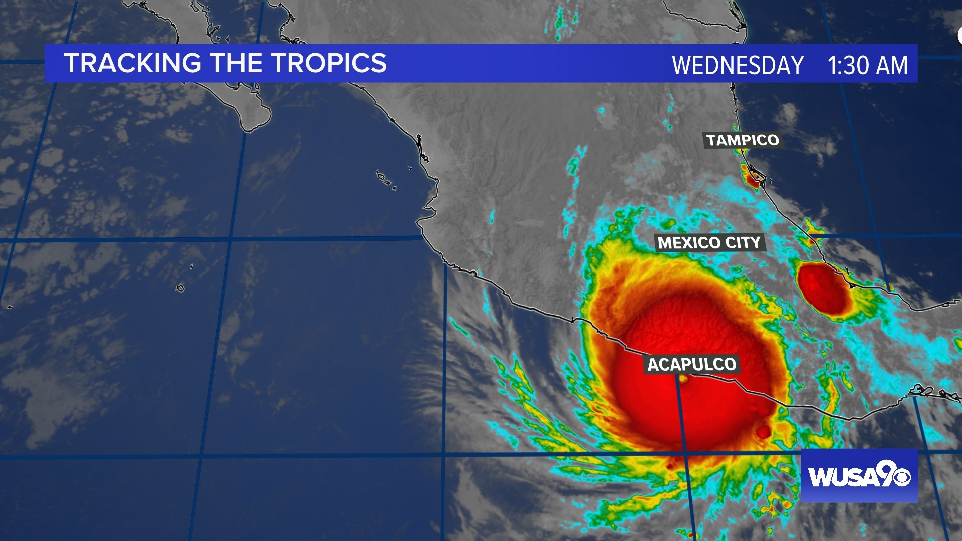
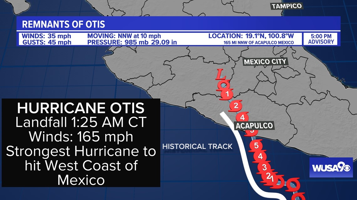
Otis made landfall near Acapulco, Mexico about 1:25 a.m. Wednesday, according to the National Hurricane Center.
Otis made landfall at peak intensity as a Category 5 hurricane with sustained winds of 165 mph and a minimum central air pressure of 923 millibars (mb) – almost identical to Hurricane Andrew’s intensity when it made landfall in south Florida in 1992.
Although it will be weeks, if not months, before the final damage and death toll is calculated for Otis as it continues to move further inland, several key benchmarks can be discussed now. Otis became the most powerful hurricane on record to make landfall along the west coast of Mexico.

Otis also intensified at a nearly unprecedented level, going from a tropical storm to a Category 5 hurricane in less than 24 hours, with sustained winds increasing to 110 mph in that time, according to preliminary NOAA estimates.
Hurricane intensity is measured on the Saffir-Simpson Hurricane Wind Scale which ranks storms from 1–5. Otis intensified rapidly under ideal circumstances with very warm ocean water in an area with little to no wind shear.


That’s very similar to another hurricane that developed almost eight years ago to the day in a similar location.


Hurricane Patricia set a new all-time record, on October 23, 2015, for the strongest hurricane in the Western Hemisphere. Patricia rapidly intensified from a tropical storm to a Category 5 hurricane in only 24 hours. In just one day, its sustained winds increased by 120 mph, which is among the fastest rates of hurricane intensification anywhere in the world.
Patricia’s highest sustained winds were 215 mph with a minimum central air pressure of 872 mb. Air pressure is generally considered a more accurate measure of the intensity of a hurricane. The lower the air pressure, the stronger the storm is. Standard sea level air pressure is approximately 1013 mb.
Fortunately, Patricia weakened during an eyewall replacement cycle and an increase in wind shear prior to landfall on the west coast of Mexico. Patricia was an upper-echelon Category 4 hurricane with sustained winds of 150 mph at its time of landfall.
Hurricanes Otis and Patricia will be forever linked as being the strongest and second strongest hurricanes to make landfall along the west coast of Mexico. Both formed and intensified rapidly under ideal environmental and atmospheric conditions. El Niño was present during both hurricanes, making conditions more favorable for tropical development in the east Pacific.
According to NOAA, “Greenhouse gas-induced climate warming may also have contributed to the post-1980 Atlantic hurricane changes, including the observed increase in rapid intensification, which one modeling study links in part to greenhouse gas-dominated anthropogenic forcing.”
Meteorologists and atmospheric scientists agree that hurricane intensity forecasts need additional research to become more accurate in the future as neither Otis nor Patricia were expected to intensify as rapidly as they did. That’s especially important because more people need to be evacuated for a hypothetical landfalling major hurricane than a tropical storm.