
WASHINGTON — Friday will be warm again before cooler weekend weather.
Forecast:
Tonight: Becoming mostly cloudy. Unseasonably mild. Low: 66.
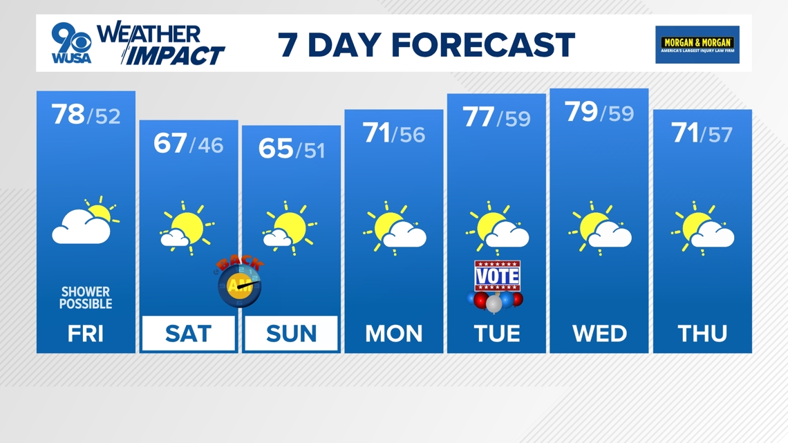
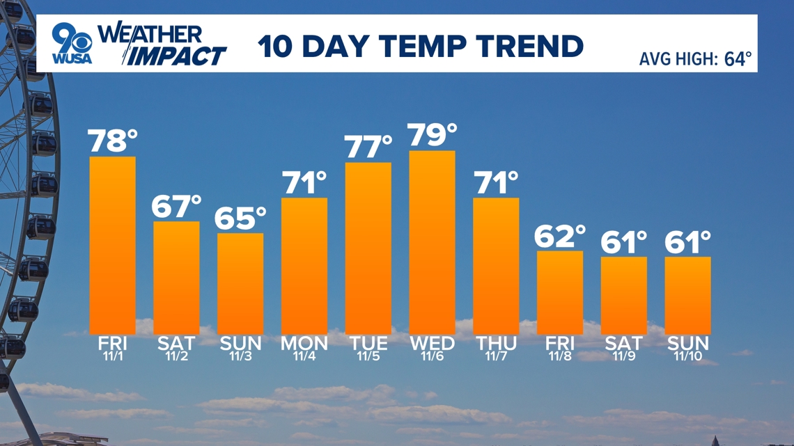
Friday: Partly cloudy with a few showers possible. Breezy. High: 78.
Friday Night: Clear and cooler. Low: 52.
Saturday: Sunny and pleasant. High: 67.
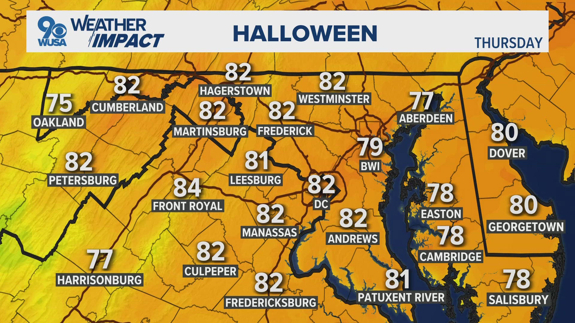
The trick-or-treating forecast looks great with partly cloudy skies and comfortable temperatures falling from the mid 70s to the mid 60s.
Clouds will increase Thursday evening ahead of a cold front Friday that may produce a few spotty showers, mostly in the morning hours. Any showers that develop will be light and scattered. Otherwise plan o mostly cloudy skies to start the day with more sunshine by the afternoon and mild temperatures in the mid to upper 70s.
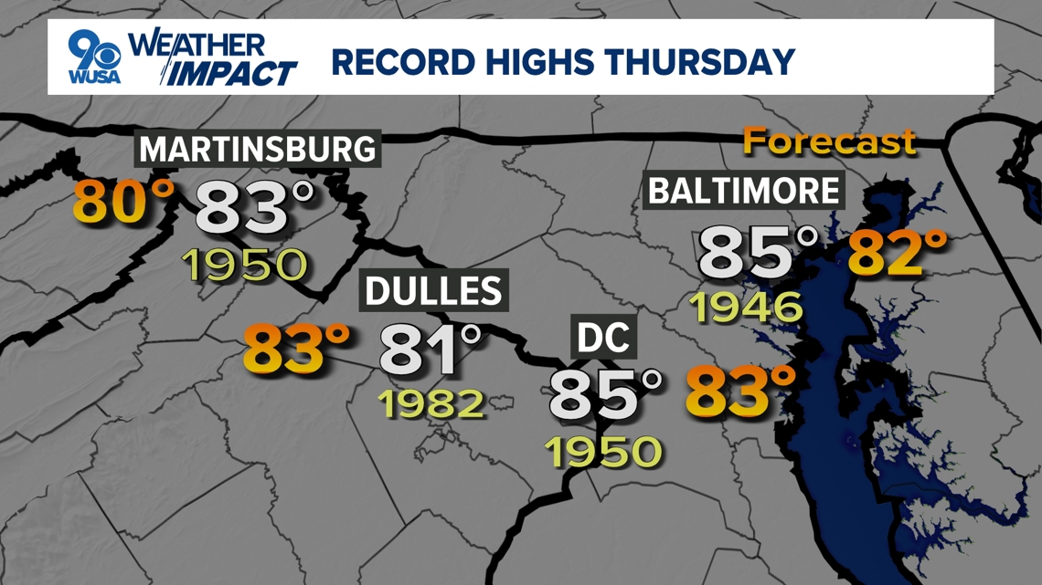
Halloween record high temperatures:
- DCA: 85° (1950)
- IAD: 81° (2004 & 1982)
- BWI: 85° (1946)

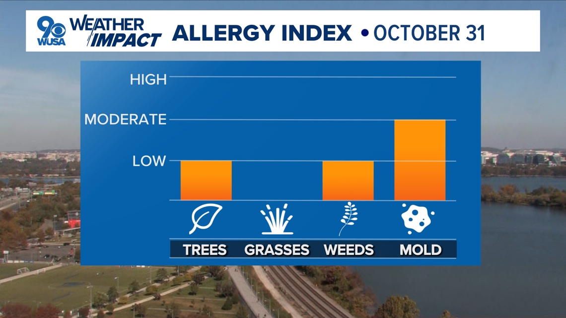
Here is the latest pollen report:

Detailed Forecast:
Tonight: Becoming mostly cloudy. Unseasonably mild. Lows: 58 - 68. Winds: SW 10.
Friday: Partly cloudy with a few showers possible. Breezy. Highs: 75 - 80. Winds: NW 10 - 15.
Friday Night: Clear and cooler. Lows: 42 - 52. Winds: NW 10.
Saturday: Sunny and pleasant. Highs: 63 - 68. Winds: NNW 10.
Temperatures will fall back into the mid to upper 60s over the weekend (which is still above average for the start of November!) with mostly sunny skies.
Don't forget, Daylight Saving time will end Sunday morning! While the extra hour of sleep will be great, the sun will set at 5:05 p.m. Sunday evening.
Another warming trend returns next week with temperatures popping back into the 70s Monday through Thursday.
Extended Forecast:
Sunday: Mostly sunny and cooler. Highs: 61 - 66.
Monday: Partly cloudy. Highs: 67 - 72.
Tuesday (Election Day): Partly cloudy. Warm. Highs: 74 - 79.
Wednesday: Partly cloudy. Very warm. Highs: 75 - 80.
Thursday: Partly cloudy. Highs: 67 - 72.


MORE WAYS TO GET WUSA9
DOWNLOAD THE WUSA9 APP
Apple App Store: WUSA9 News on Apple
Google Play Store: WUSA9 News on Android
HOW TO ADD THE FREE WUSA9+ APP TO YOUR STREAMING DEVICE
ROKU: add the channel from the ROKU store or by searching for WUSA9.
For both Apple TV and Fire TV, search for "WUSA9" to find the free app to add to your account. Another option for Fire TV is to have the app delivered directly to your Fire TV through Amazon.