WASHINGTON — Halloween will be quite different than years past, but many people will still celebrate the occasion in costume with some outdoor activities. So what will the weather be like for Halloween? Even though it's still nearly two weeks away, we have some clues now.
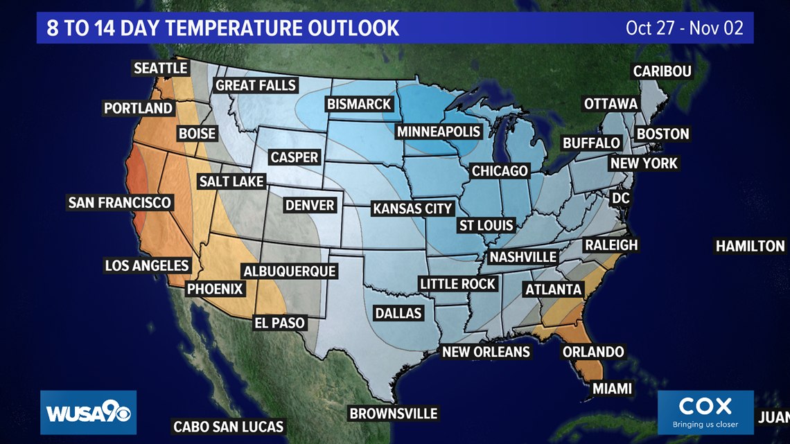
The forecast for the final days of October points to cooler-than-average weather for the DMV, according to the Climate Prediction Center Typical high temperatures this time of year are in the low 60s, so this may be a signal for cool days.
Below is a forecast for Tuesday, Oct. 27 through Monday, Nov. 2. The blue color indicates temperatures are likely to be below normal (cool).

We can also look to climatology to help predict Halloween weather. For Oct. 31, the average high temperature is 64, with an average low of 46. Snow is rare on Halloween and heavy rain is unlikely, but not unprecedented; the DMV saw over an inch in 2019. Considering the weather pattern this month, heavy rain remains unlikely in 2020.
Over the last five years, temperatures have reached the 60s or warmer on Oct. 31. In fact, last year the D.C. Metro region topped out at a balmy 77 degrees. It was also a stormy and wet Halloween, with strong storms in the D.C. area. National Airport recorded1.25 inches of rain on Halloween 2019, just .05 inches away from the daily record. The previous four Halloweens were dry.
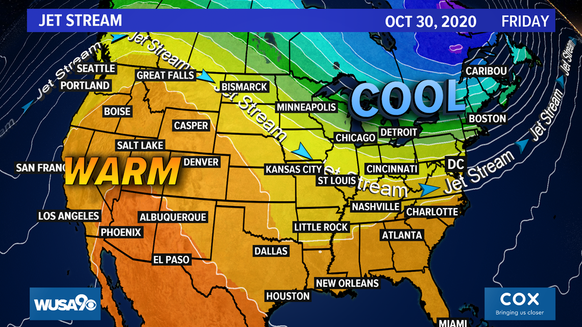
Lastly, let's look at weather model data, which extends through early November. This is where we may have the best information.
Below is a map using GFS (American) model forecast data. It points to a “trough” or area of low pressure over the eastern half of the United States on Friday, Oct. 30. This means it’s likely that a cold front will be moving through or would have moved through the D.C. area by Halloween. Temperatures for that same model are in the 50s for daytime highs on Oct. 31.
If this forecast holds, it would make this the chilliest Halloween since 2014. Additionally, with a front nearby, rain cannot be ruled out just yet.

Of course, just like the weather, the forecast will change. Stay tuned to WUSA 9 via our app and on-air forecasts as we get closer to Halloween.