WASHINGTON — Your read the headline correctly. The wedge, or cold air damming, describes an atmospheric setup where a wedge of cold, dense air is forced down the East Coast to the east of the mountains.
But in the DMV, when this wedge of cold air comes ahead of a storms system, we can be left with a mixed bag of winter weather. Snow, sleet, and freezing rain.
Wedge winter weather events have played a part in some of DC's most notorious ice events, like the Ice Storm from 1999.
Weather Setup
Atmospherically, the large scale setup includes a big dome of high pressure to our north. This dome of high pressure has cold air. With the clockwise circulation of winds around this high, the cold air travels from our north and is funneled down the East Coast and pushed up against the mountains.
Because cold air is dense, it nestles itself on the ground and can be very stubborn to erode away.
But the problems arise when a storm system with moisture encounter this wedge of cold air.

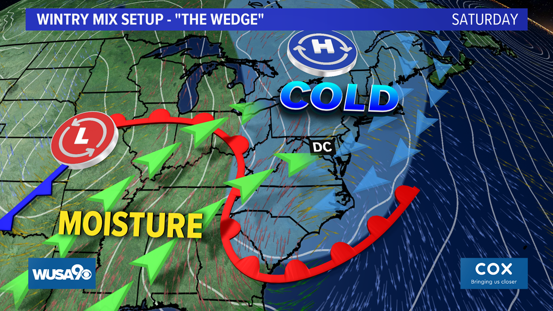
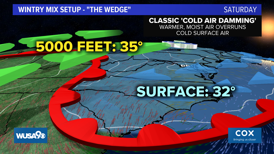
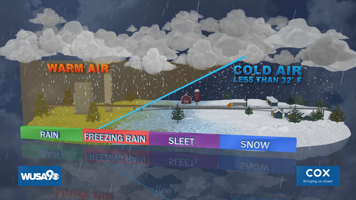
Take this storm system for this weekend as an example. The moist air pushing its way in is warmer than the wedge of colder air. So the warm air, being less dense, overruns the cold air at the surface. The cold air is stubborn to erode, but as it does so, the precipitation types change from snow to sleet, then freezing rain and finally rain.

As a forecaster in the D.C. area, your first time predicting the erosion of a wedge can bite you in the butt, really. If you just look at weather models and don't use your instinct, you'll often predict a temperature warm-up much quicker than it will actually happen.
How the wedge translates to a wintry mix
The cold air brought down the East Coast from the wedge is very dense. The warm air is less dense, so it overruns the cold air. This means that the warm air is stacked on top of the cold air.
So if you take a snowflake falling from a cloud, when it falls down into the warm air, it melts. But when it hits this cold air still at the surface from the wedge, it can either refreeze into a little ball of ice known as sleet, or it can refreeze on contact as freezing rain.

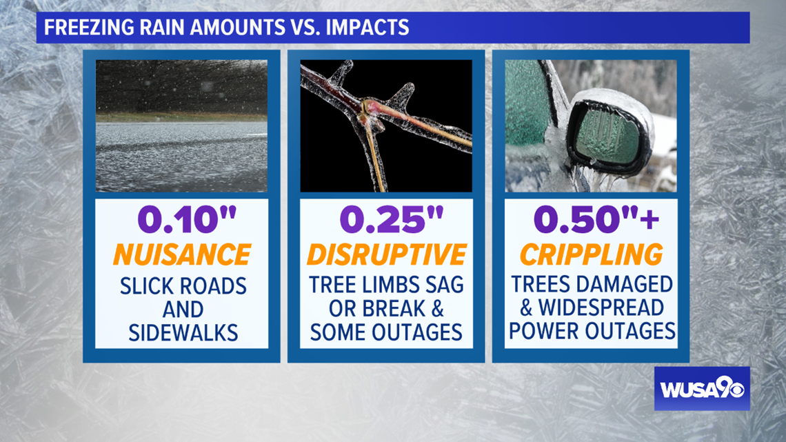
How much freezing rain is too much?
With freezing rain, it only takes a glazing of ice to cause problems if cold enough temperatures are in place. Sidewalks and untreated roads can turn slick.
When ice totals get to a quarter of an inch, this is enough to cause tree limbs to sag or break. You can even begin to see some isolated power outages. Ice storms become more crippling when the totals near half an inch, at which time widespread power outages become possible.