WASHINGTON — WUSA9 has declared a Weather Watch Alert for showers and storms in the forecast Tuesday. Some of the storms will produce heavy rain and gusty winds.
This means the rain could be heavy and make it difficult for you to see as you are driving. It may also delay or cancel outdoor plans and slow down traffic.
Some of the stronger winds could snap a weak or vulnerable tree in some neighborhoods. The chance is small and shouldn't be widespread. The key timing for showers and storms is 2 p.m. - 10 p.m. Over the immediate D.C. Metro area, storms will be likely between 5 p.m. and 10 p.m.
Here's the timeline for the rain and storms on Tuesday.
Tuesday
Daybreak - 2 p.m. Mostly sunny, heating up.
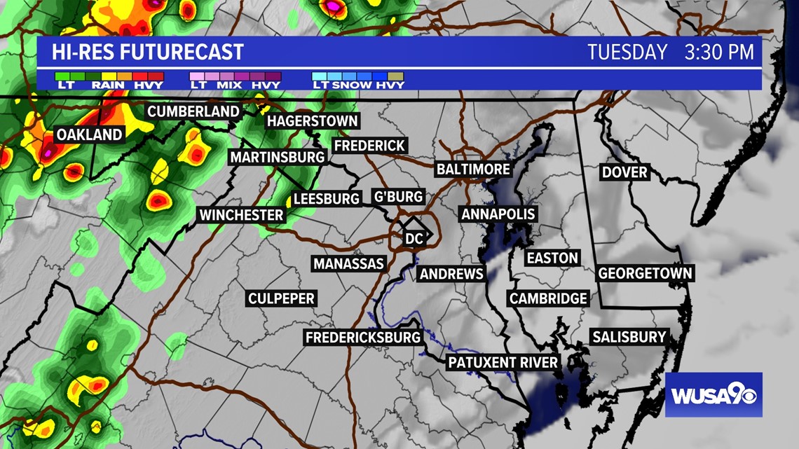
2 p.m. - 4 p.m. Showers and storms start developing over the western suburbs. Areas such as Winchester, Luray, Oakland, Cumberland, Hagerstown, Martinsburg and Frederick will see the showers and storms develop first.
4 p.m. - 6 p.m. Showers and storms start to spread into the immediate D.C. Metro area including Western Loudoun, Manassas, Culpeper, Northern Montgomery County, Fairfax, Alexandria.
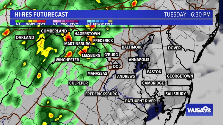
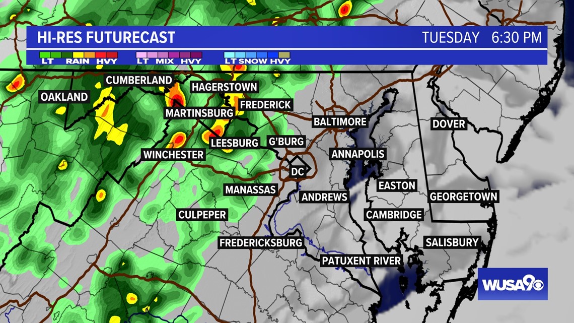
6 p.m. - 8 p.m. Storms over most of Metro D.C. including D.C., Prince George's, Charles County, Anne Arundel County.
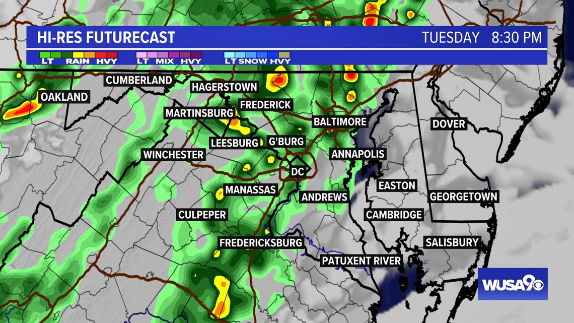
8 p.m. - 10 p.m. Showers and a few storms still over D.C., but gradually moving east. Showers and storms will still be over areas such as Prince George's County, Montgomery County and push toward the Eastern Shore. Western suburbs such as Loudoun will gradually begin to dry out.
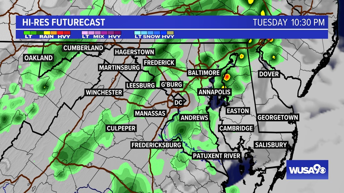
After 10 p.m. - Showers and storms move toward Delaware and gradually end in Metro D.C.
TUESDAY 3:30 PM

TUESDAY 6:30 PM

TUESDAY 8:30 PM

TUESDAY 10:30 PM