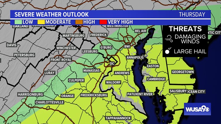
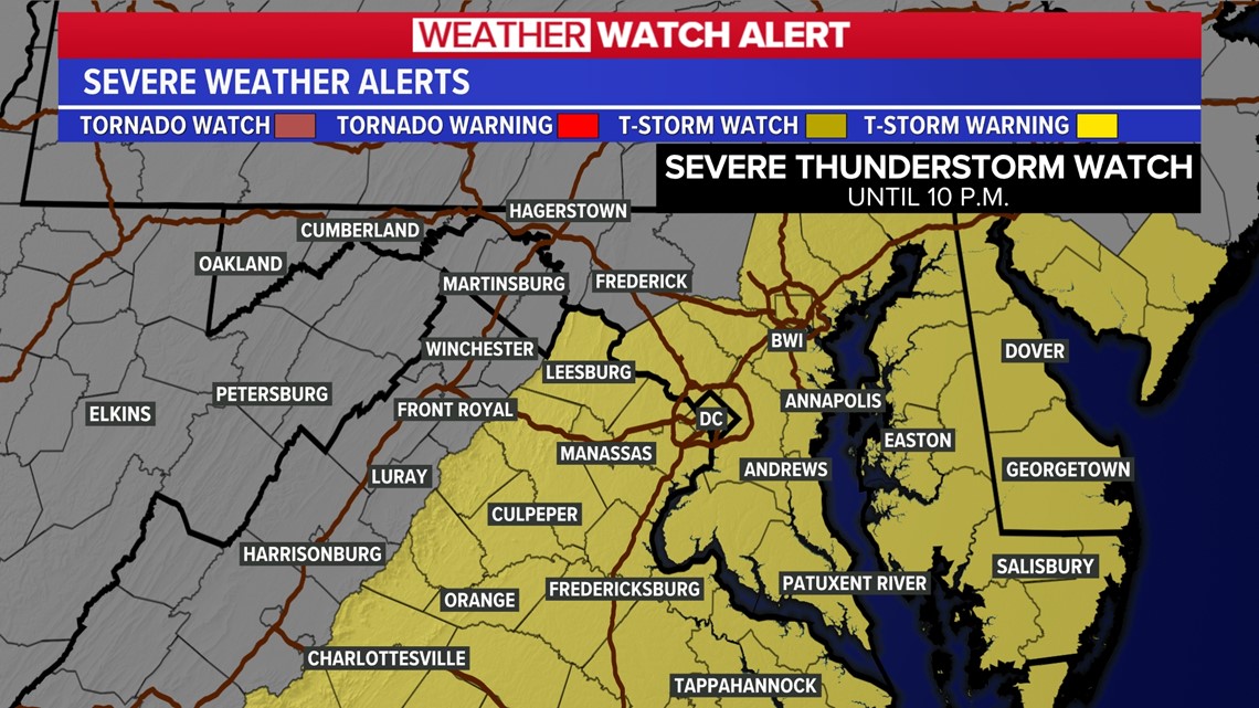
WASHINGTON — A Severe Thunderstorm Watch has been issued for metro DC and surrounding counties until 10 pm.

Strong to severe storms are possible as we head throughout the evening. The main threats today are damaging wind (gusts 58 mph) and hail.
Here is a timeline to help you plan around the storms:
- Now - 6 p.m. - Showers and storms will develop. Some storms will pack heavy rain, gusty winds and hail.
- 5 p.m. - 8 p.m. - Showers and storms continue. Some storms will contain heavy rain, gusty wind and hail.
- 8 p.m. - 10 p.m. - Stronger storms will gradually move out of the area. A few showers will still be possible.
In some neighborhoods, the storms will be strong enough to cause power outages, falling trees and snap tree branches.
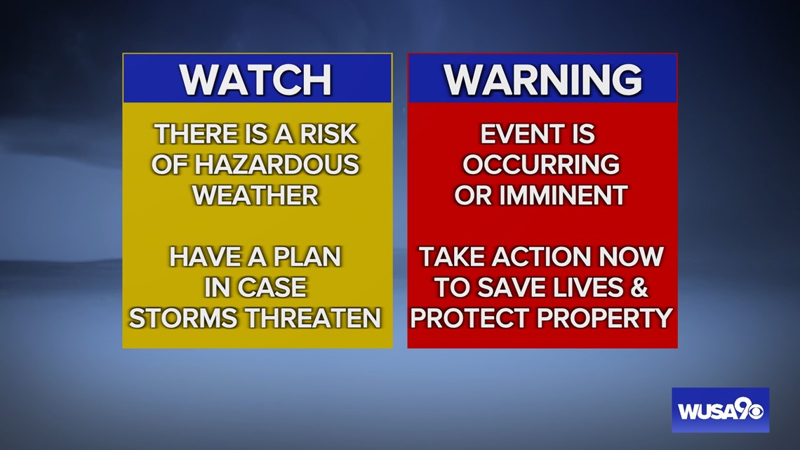
Severe Thunderstorm Watches and Warnings may be issued for your neighborhood. A "Severe Thunderstorm Watch" means severe storms are possible and to mindful and ready to take action if needed. A "Severe Thunderstorm Warning" means that a severe thunderstorm is happening now or will happen soon. Be prepared to protect yourself.
A severe storm is a storm that produces either of these:
- Damaging wind gusts 58 mph or stronger
- Hail 1 inch or larger
If a tornado has been detected in the storm, a Tornado Warning will be issued.

If you are caught outside in a storm, take shelter inside. Standing under a tree is not a safe place as a tree could fall on you if the wind knocks it over and it's not good protection from lightning.