
WASHINGTON — Parts of the D.C. Metro region could see some flurries or light snow Monday.
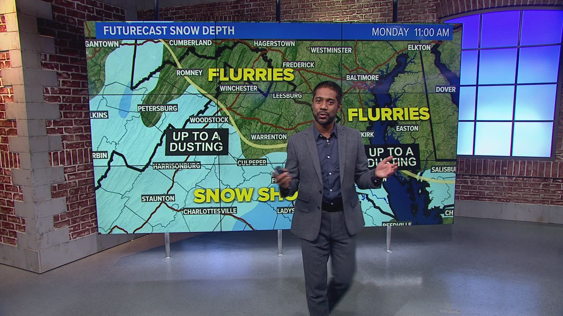
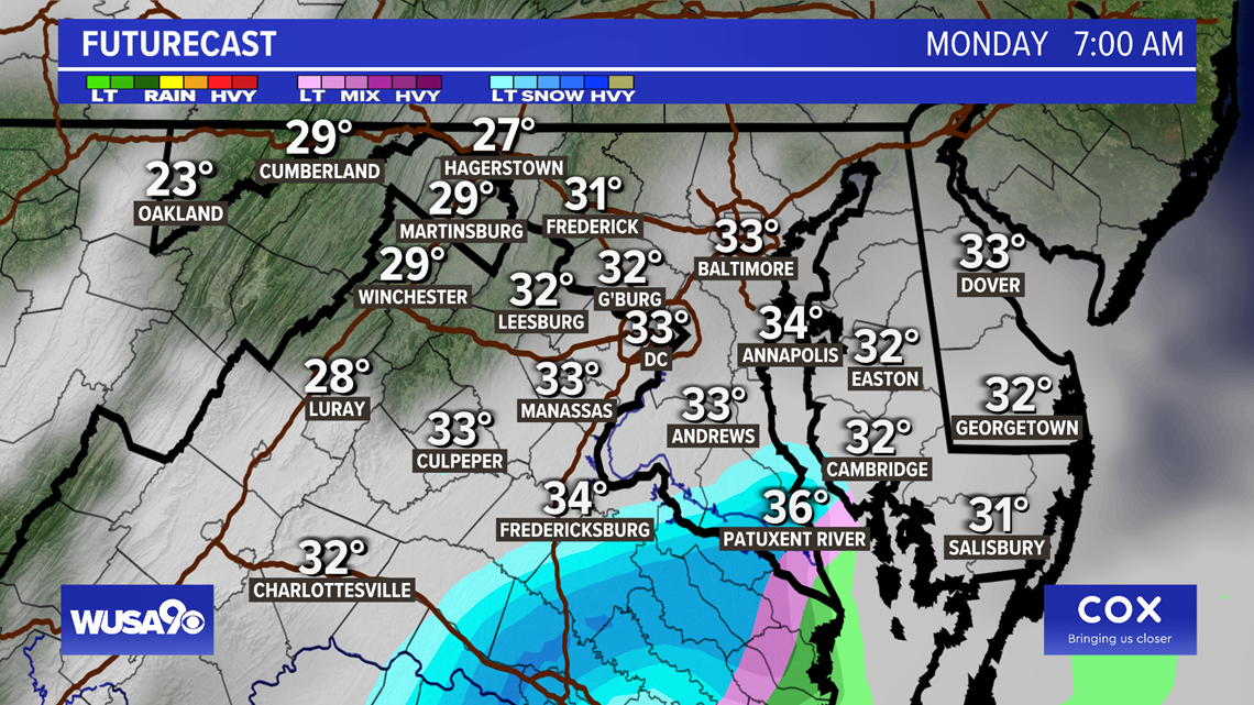
The weather system will likely bring flakes across central and Northern Virginia, with upwards of a dusting of snow across central Virginia and parts of Southern Maryland. Metro D.C. is likely to see flurries, with little to no accumulation in snow. Critical timing for flurries and snow showers is 4 a.m. until 10 a.m. Monday.
Now, don't expect it to stick to the ground and build up.
Typically for snow, you won't see a disturbance accompanied by cold air and moisture.
Cold air on Monday morning? Check. Moisture on Monday? Not so much.
Simply put, low pressure will be passing south of the area and with some cold air in place, this could trigger light snow and flurries for a brief moment Monday morning. However, the odds are not in our favor for everyone to get flakes. The further south you are, the better chance you have of spotting some flurries.
We should caution that all of this is contingent on the setup that will allow moisture to flow into the area. If that doesn't happen, then it will be cloudy, cold and dry Monday morning.
Timing:
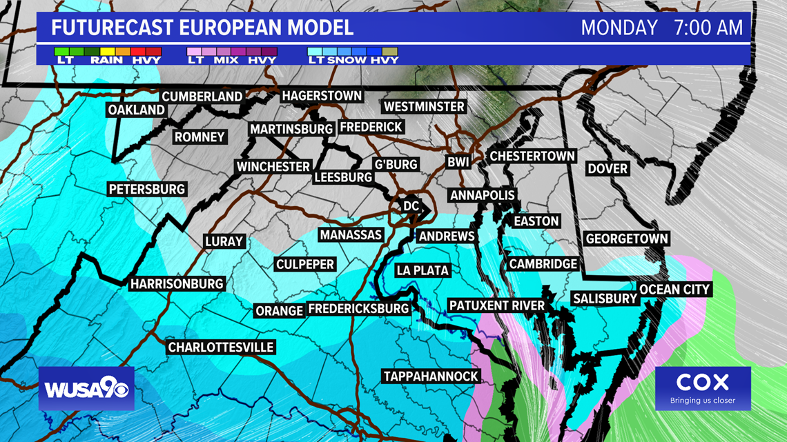
If all of the ingredients come together we could see rain and snow around 2 a.m. mainly in the southern suburbs such as Manassas, La Plata, Culpeper and Fredericksburg and Spottsylvania.
By 4 a.m., we could see a change over to light snow and flurries with flakes in Andrews, the very southern edge of D.C., Alexandria, Fredericksburg, La Plata and Culpeper. Most guidance keeps it well south of D.C.
8 a.m.: Snow and flurries start to retreat further south, we see a gradual change over back to rain and snow, especially along the Eastern Shore.
10 a.m.: Rain and snow mainly be in Southern Maryland as the system gradually moves out.
12 p.m.: Done.
Accumulation: Dusting on the roof, grassy surfaces if any. Think "conversational" snow.

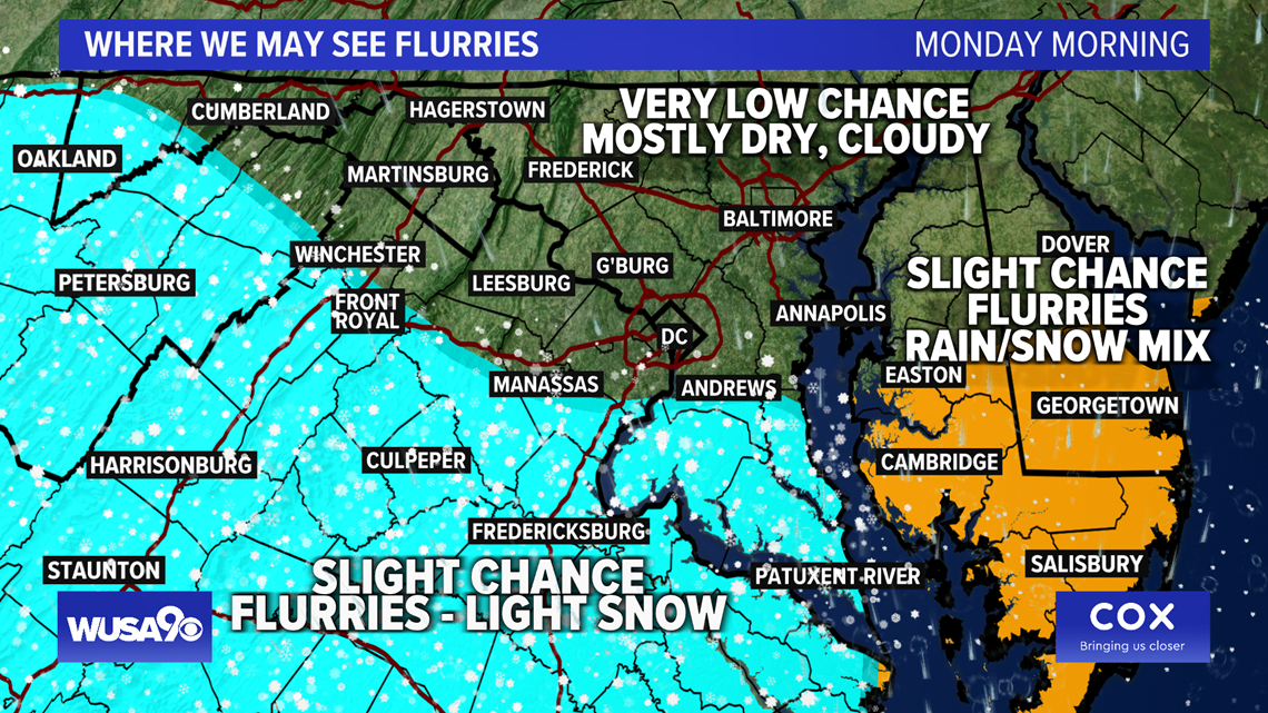
Here are the areas that are most likely to see some flurries Monday morning.

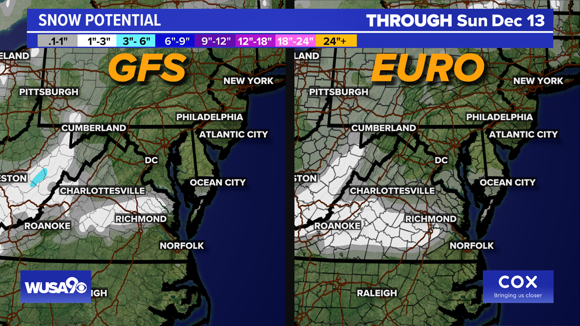
Models
Most of the modeling favors light snow and flurries or a brief mix around areas such as Fredericksburg, Stafford, Culpeper, La Plata, Quantico.
The European model has been the most aggressive giving the region the most moisture for snow.
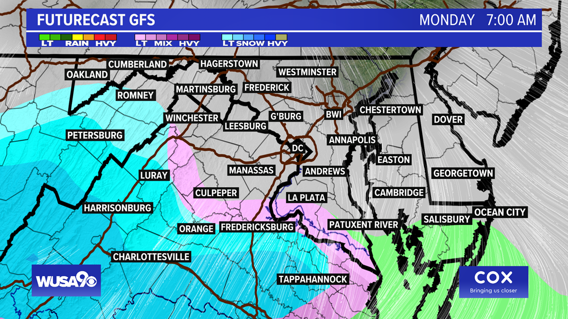
The GFS has now come around to the possibility of some flurries and a rain and snow mix south of D.C. The RPM brings a few lligt snow showers to Fredericksburg and areas south of Fredericksburg.
The NAM has a few flurries, mainly early in the morning and it has some flurries over most of the Metro, including D.C. The NAM may a bit too bullish.
The extended HRRR is the most "excited" of what we call the high-resolution models, it brings a swath of snow showers across Virginia on Monday morning. The GDPS is mostly dry and has a few flurries over Southern Maryland and closer to Richmond, VA.
The majority of models keep the flurries and light snow in our southern suburbs with little to no accumulation Monday morning.
On a scale of low, medium, high, at this point, we think that the chance is LOW.
Here's a look at the Euro vs the GFS modeling. You can see that the Euro has some light snow and flurries while the GFS has a mix of rain and snow and light snow near Fredericksburg. The RPM has snow just south of Fredericksburg, closer to Richmond, VA.


Please check back for updates.