WASHINGTON -- Many are wondering what type of winter could see around DC. For the answer we check out what's happening in the ocean.
The Climate Prediction Center is forecasting a 60 percent chance of El Niño in the fall and an El Niño Watch has been issued. For winter the forecast is 70 percent.
Usually with an El Niño winter in DC, we get a wetter winter, usually more snow and near average temperatures. A spike in snow, depends on the strength of the El Niño.
On average, a stronger El Niño leads to warmer and wetter winters in the DC Metro. During a strong El Niño, DC can get more snow or rain and other forms of precipitation.
For snow lovers, cross your fingers for a moderate El Niño. That pattern has a tendency to give DC more snow and colder than normal temperatures.
A weak El Niño usually gives DC below average temperatures and normal or below normal snow.
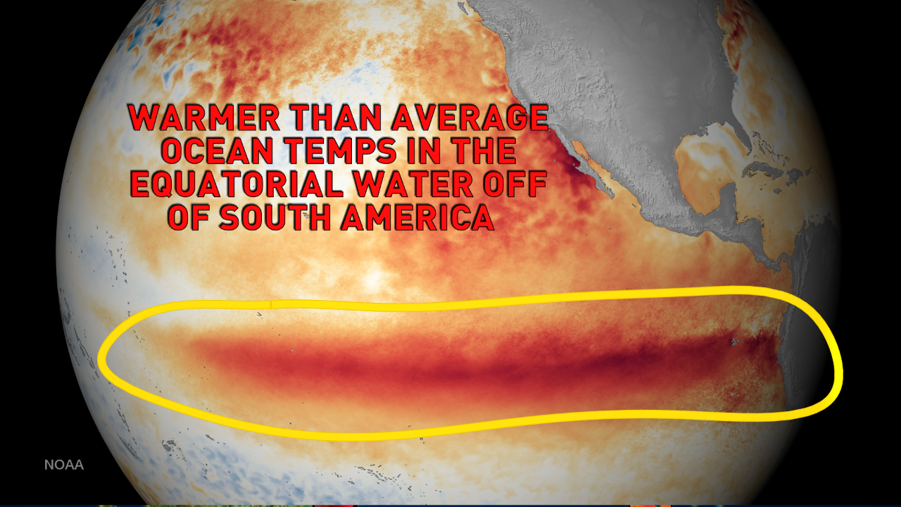
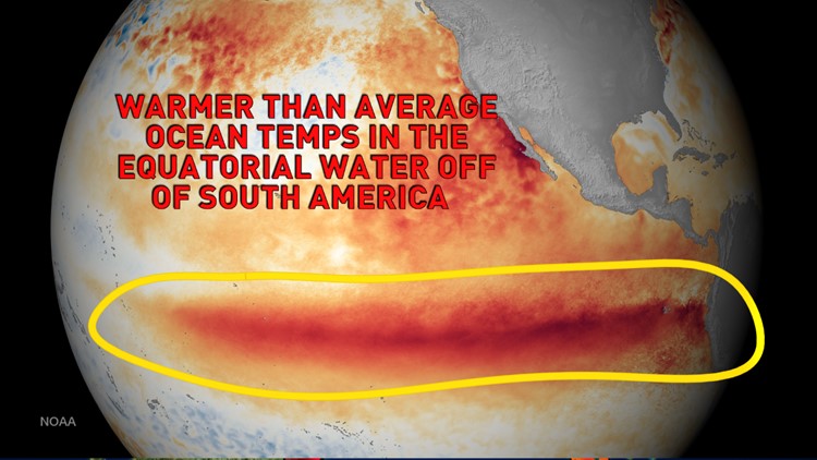
El Niño is defined by the National Weather Service as "... The large-scale ocean-atmosphere climate phenomenon linked to a periodic warming in sea-surface temperatures across the central and east-central equatorial Pacific".
In short, the Pacific Ocean is warmer. That warmth helps to drive our weather patterns. We typically get more storms from the south and storms such as Nor'easters are a little more common.
It's still way too early to know how strong the El Niño will be and what impacts it may have on the upcoming winter.