WASHINGTON -- While ridership on the D.C. Metro has been down in recent years, it still moves more than 600,000 people on an average day – and proximity to a station remains an important consideration for where people choose to live.
For those moving to D.C. – particularly from places without a comparable public transportation system – it can be hard to gauge on a map how close the nearest Metro station would actually be in walking minutes from a potential apartment.
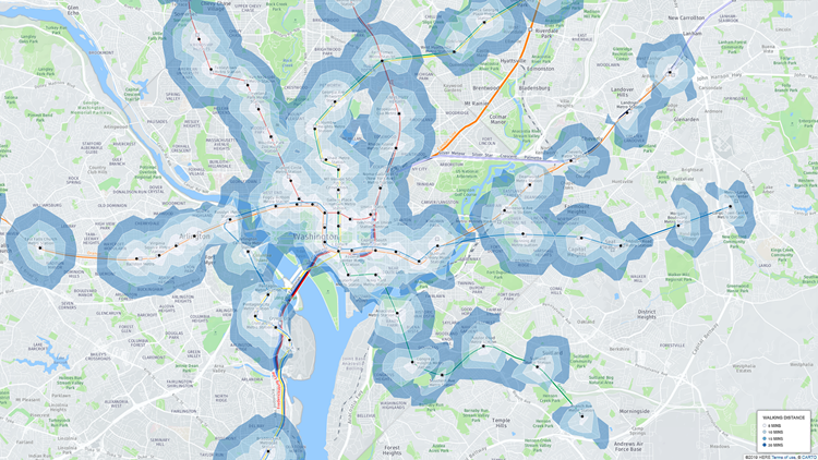
We've created an interactive map to help answer that question.
Using data from OpenRouteService, we calculated walking ranges within 5, 10, 15 and 20 minutes from every one of Metro's 91 stations.
So if you're looking for a new place in D.C. – or you're just curious to see if our calculations match up with your walk time – take a look at the map below.
---
Jordan Fischer is a data reporter for WUSA9. Follow him on Twitter at @JordanOnRecord.