

Dangerous heat settles in this week over the Mid-Atlantic. We're expecting the hottest temperatures of the summer so far, as well as very high humidity. Plan ahead to limit time outdoors in the afternoons when it will feel the most uncomfortable outside. Monday's highs were in the low 90s, but by Thursday: near record temps and a heat index between 105º - 109º!
Thursday will be the most uncomfortable with highs in the mid to upper 90s. We'll only see a few storms on Thursday, but scattered storms will cool many more of us down by Friday but it will still be oppressively humid. Some of the storms on Friday will reach severe limits.
We'll also make a run at a few records highs on Thursday:
DC - 100 (1954)
Dulles - 97 (1986)
Baltimore - 99 (1966)
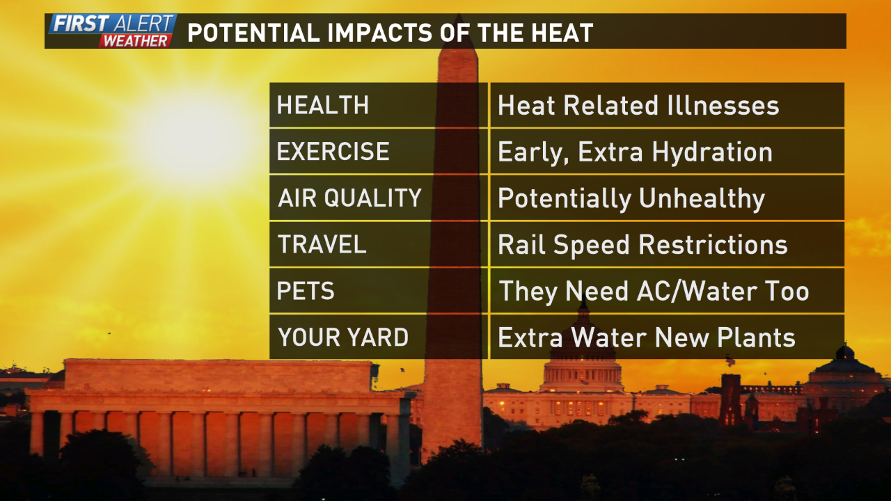
Potential Impacts go further than just leading to quicker heat exhaustion when you are exercising. Even when you aren't exercising, youth and elderly or those with weaker respiratory systems can easily over-exert themselves when it gets this hot. For children - playground equipment can get very hot in the sun so avoid playgrounds during the heat of the day. Don't forget about your pets too - they need extra hydration and a cool place to hide each afternoon.
When does the heat break? It looks like the worst of it ends for the weekend, but we'll still hover high temps on either side of 90 degrees. For the extended forecast and weather alerts, download the WUSA 9 App or go to our local forecast page here.