The critical time for high winds is from NOW - 9 AM Saturday. Winds in that time frame will still gust to or over 50 mph. On Saturday, we could still see gusts to 40 mph through noon.
An area of low pressure is "bombing out" off the New England coast. This deepening storm will create near hurricane force winds in coastal New England.
A HIGH WIND WARNING has been issued for the entire WUSA9 viewing area through Saturday morning.
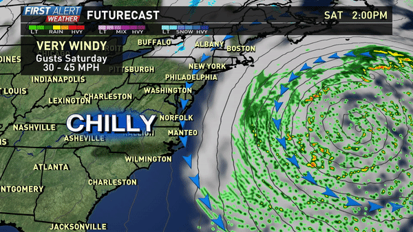 Gusts over 50 mph will still be possible into Saturday morning.
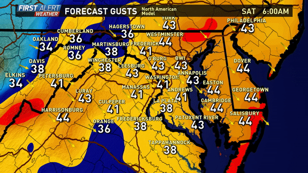
Here is the NAM model forecast for wind gusts for Saturday. While still a very windy day, not nearly as windy as Friday.
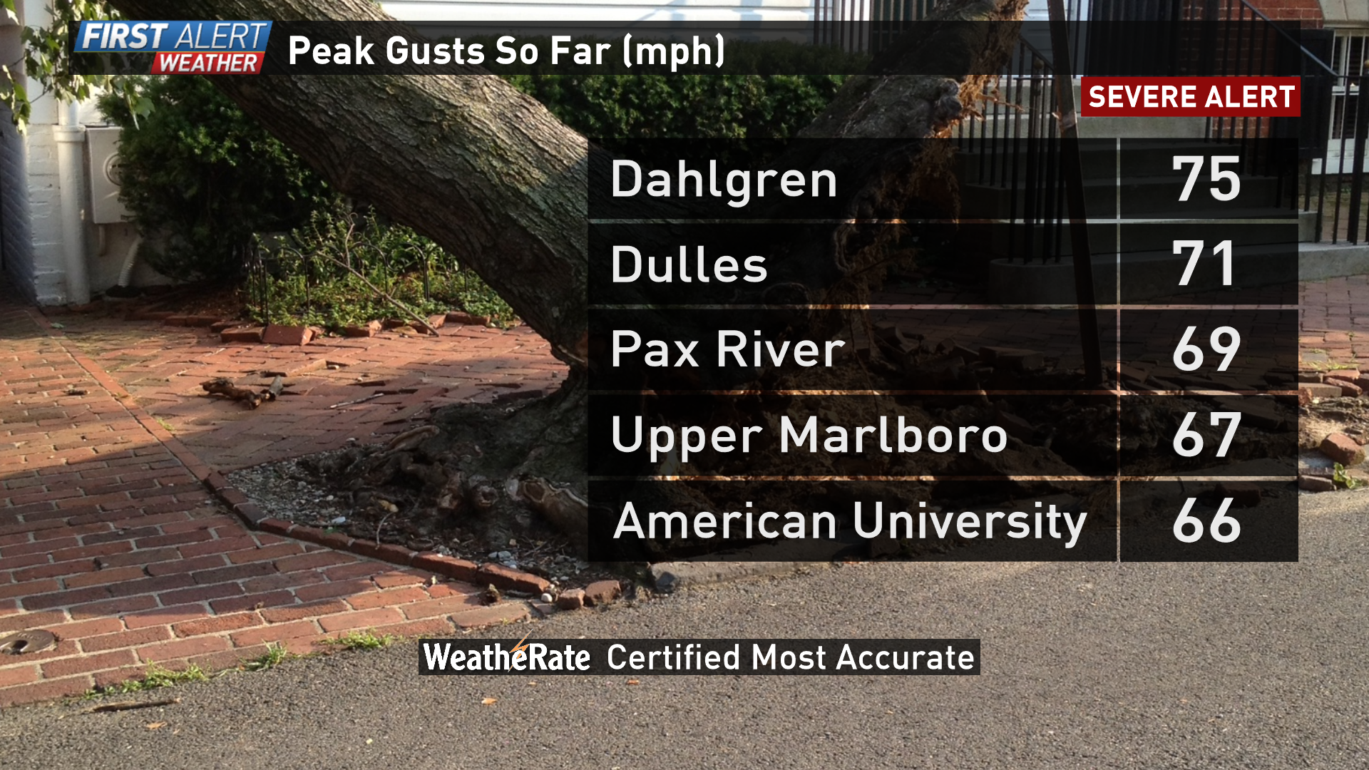
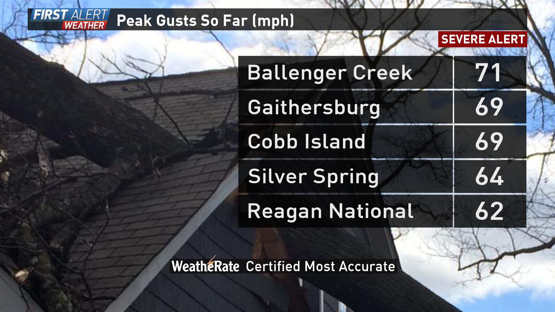
On Friday, there were several gusts over 70 mph across the region.
These winds rivaled the Derecho from June 29, 2012...One major difference between the 2012 Derecho and this storm is that the Derecho hit in late June, when trees had a full set of leaves to better catch the wind. Without leaves, we had fewer trees down than in 2012, but there were more than 500,000 customers who lost power.
Select Wind Gusts (MPH) from June 29, 2012 (Derecho Event)
- Reagan National 71
Virginia
- Dahlgren 82
- Dulles 71
- Sperryville 70
- Ashburn 70
- Qunatico 66
- Winchester 63
- Leesburg 60
Maryland
- Swan Point 77
- Waldorf 71
- BWI 66
- Beltsville 65
- Walkersville 59
FORECAST | Latest WUSA9 First Alert Weather Forecast