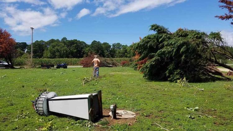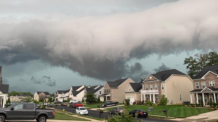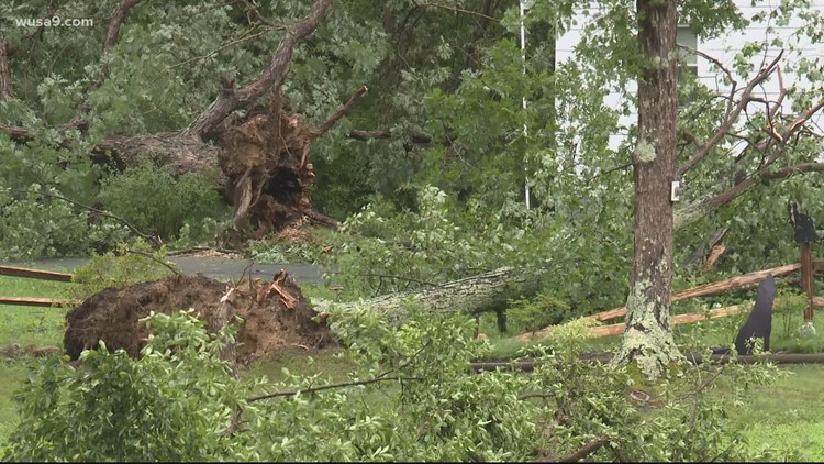
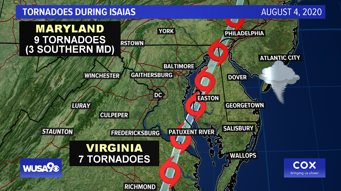
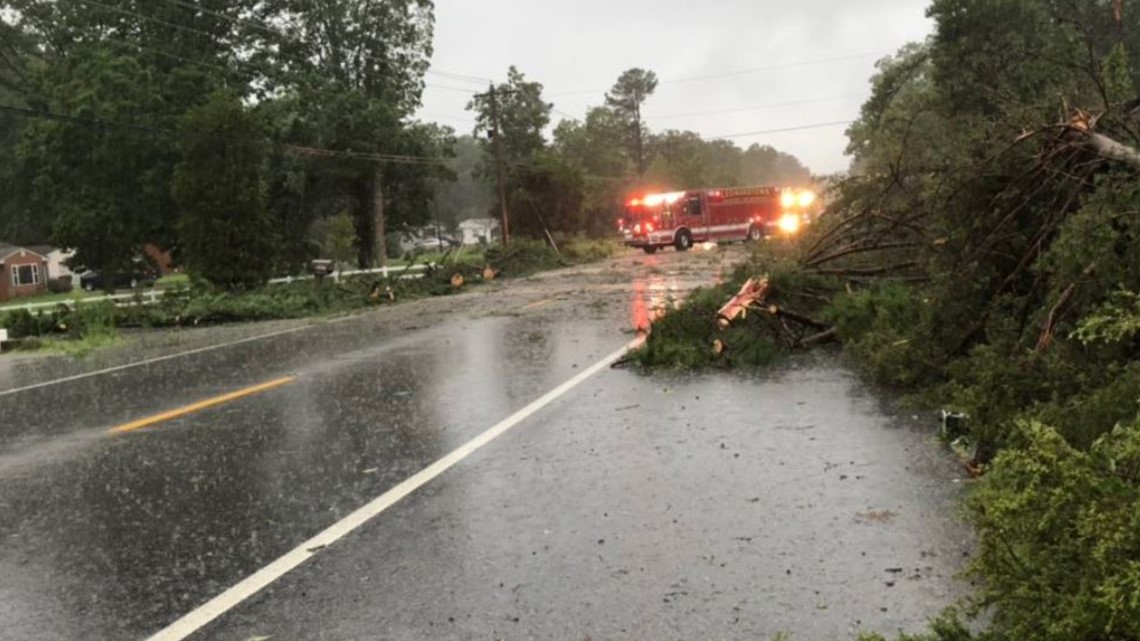
WASHINGTON — Widespread damage was reported across the DMV as Tropical Storm Isaias made its way up the East Coast. Southern Maryland felt the brunt of the storm, with the National Weather Service confirming three tornadoes touched down Tuesday morning.
Leonardtown, Maryland issued a 7-day State of Emergency after tropical storm-force winds moved through St. Mary's County early in the afternoon.
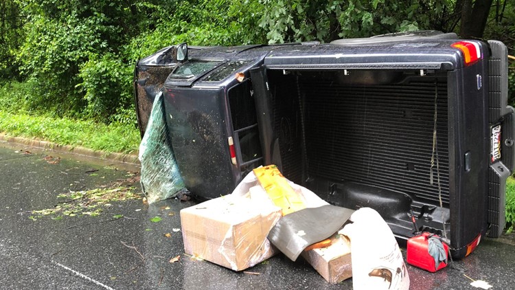
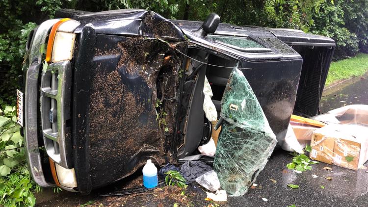
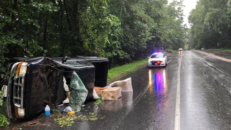
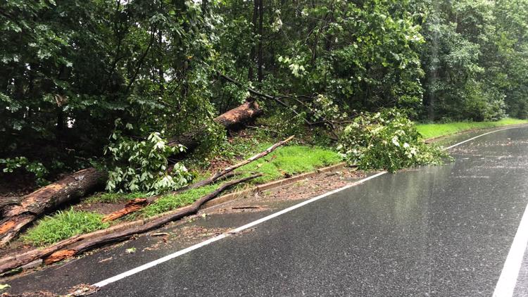
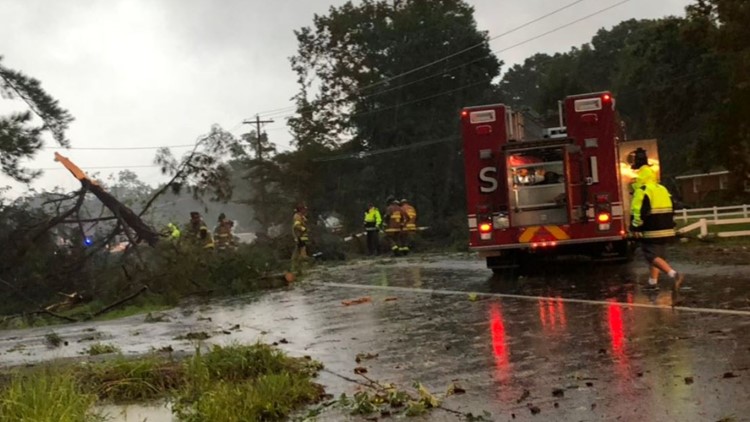
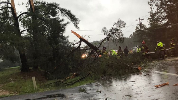
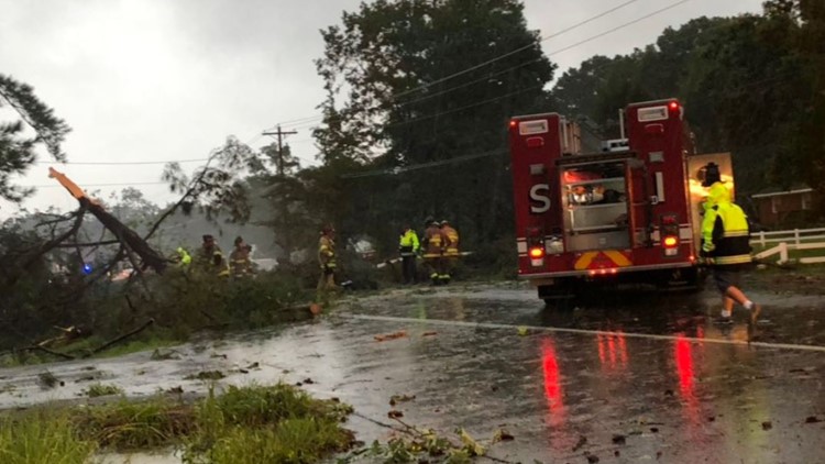
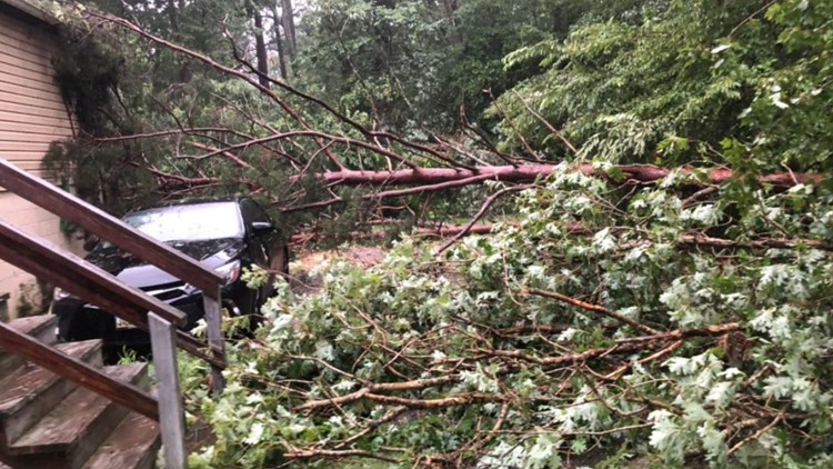
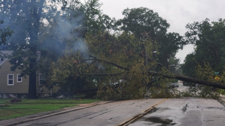
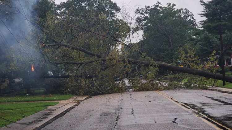
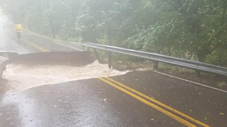
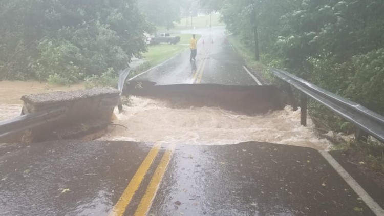
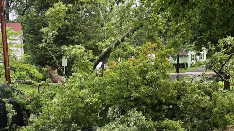
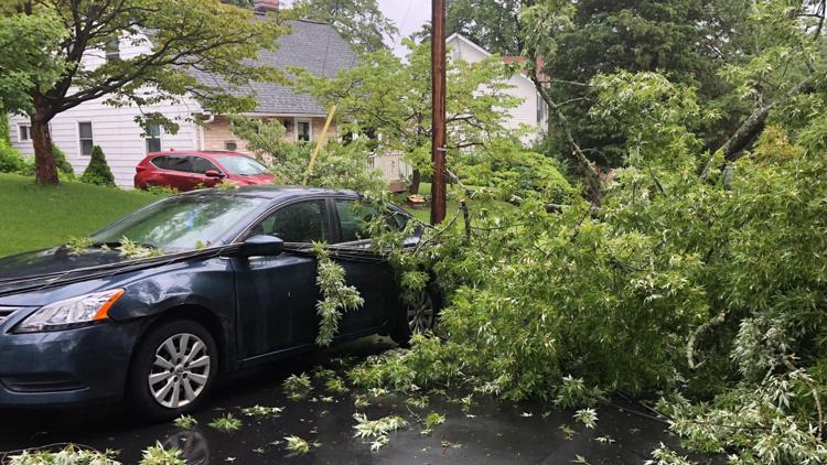
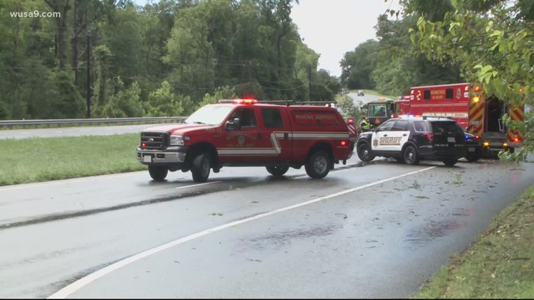
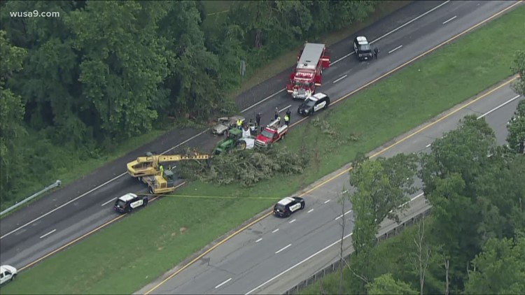
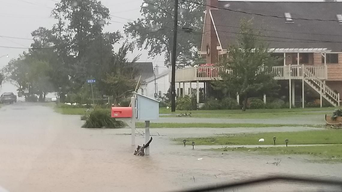
Flooding, beach erosion and gusty winds impacted the area, with at least one storm-related death reported in St. Mary's County after a tree crashed down on a moving vehicle off Route 5. The victim was pronounced dead at the scene.
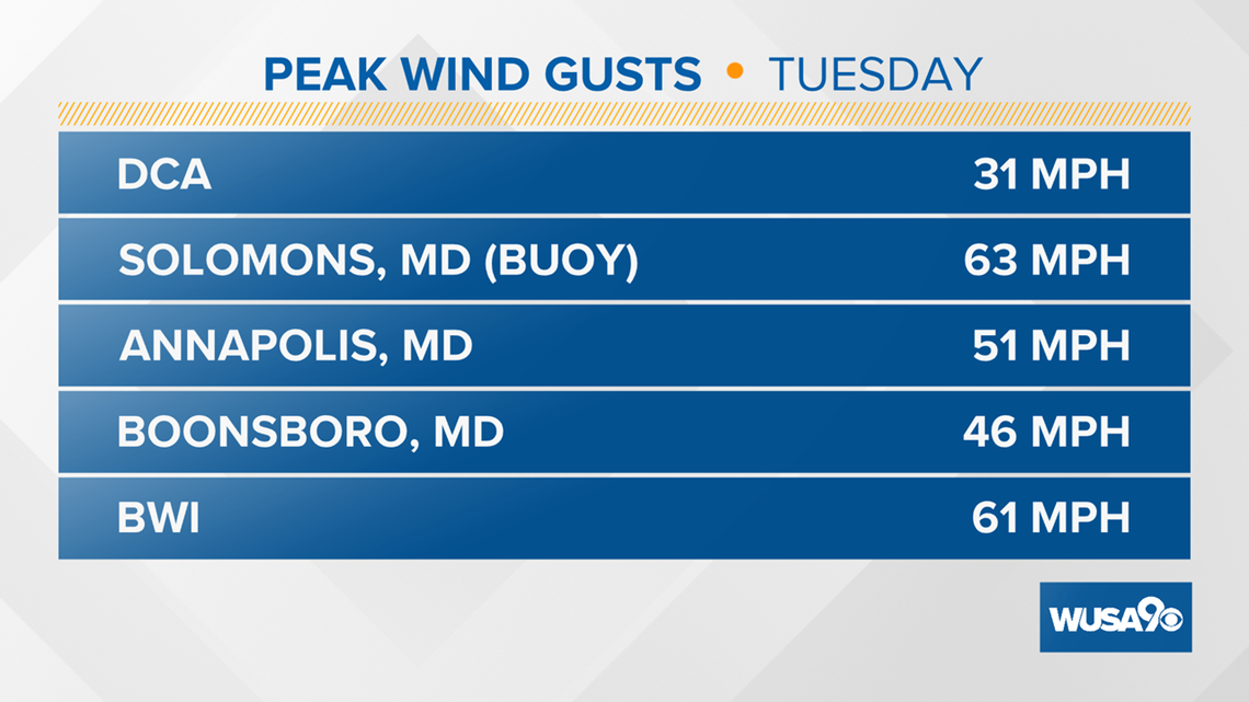
Winds gusted up to at least 56 mph in Annapolis and up to 69 mph at ocean resorts.
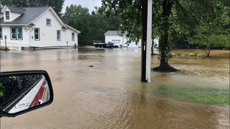
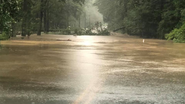
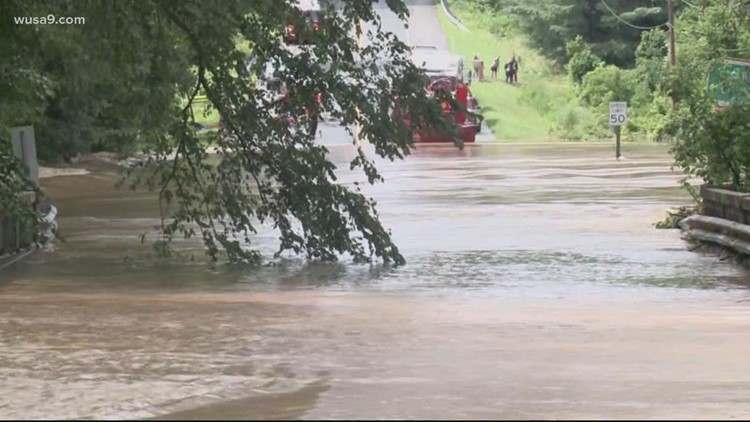
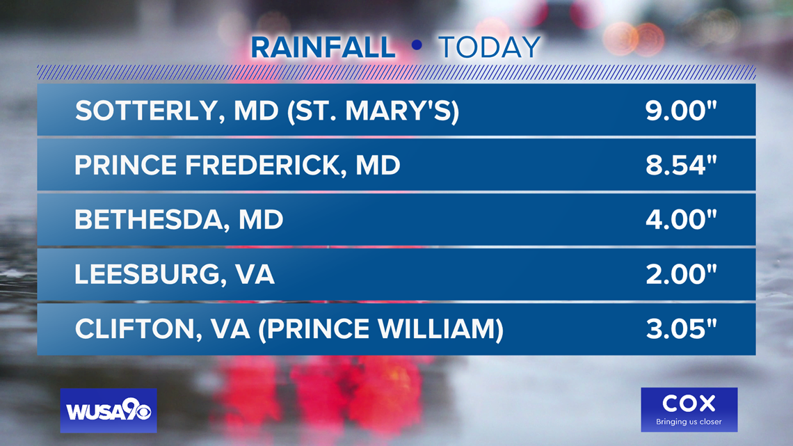
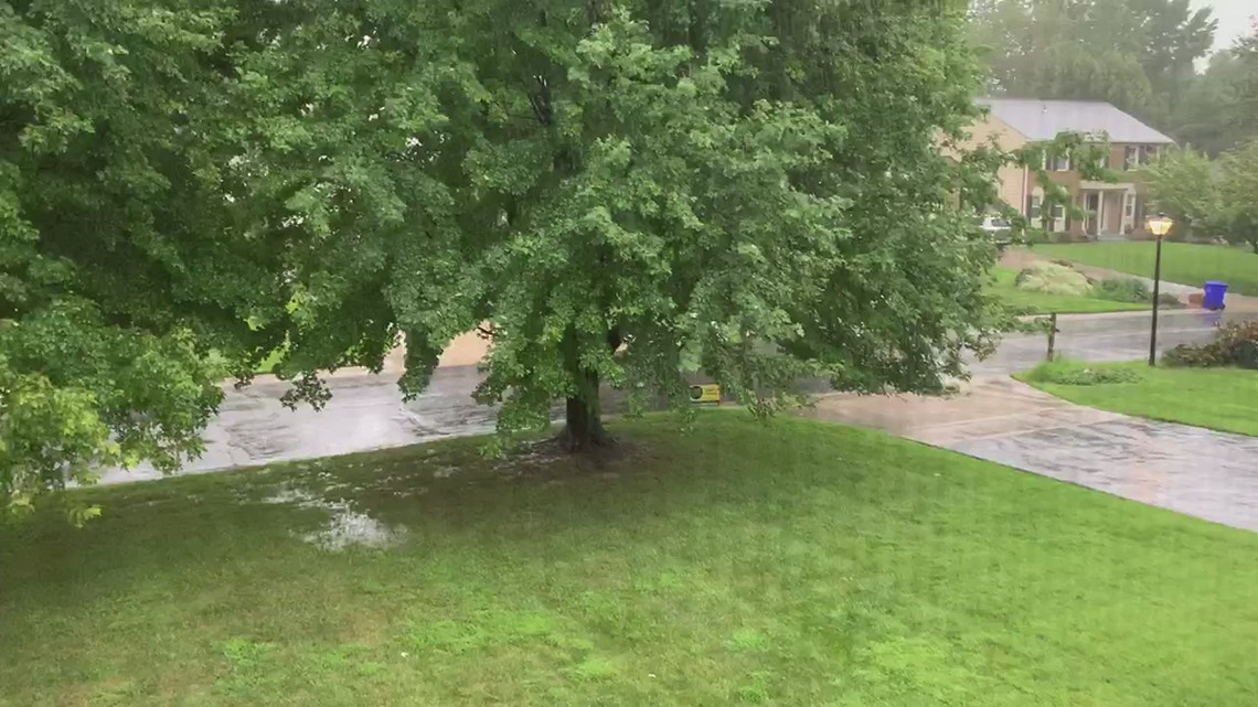
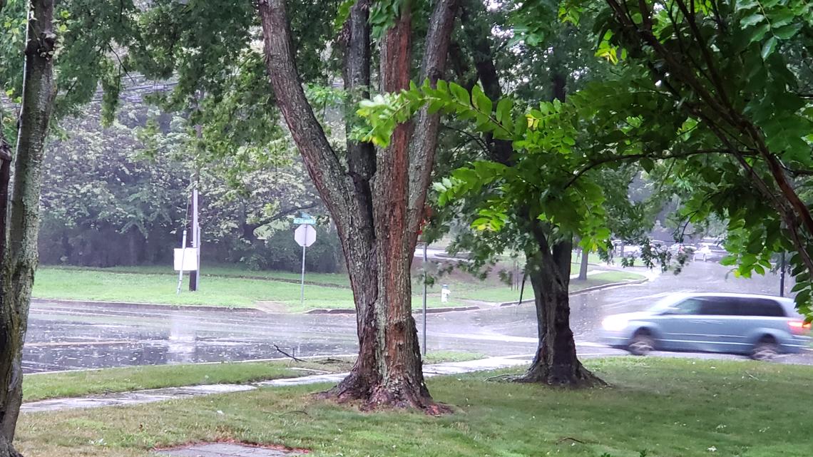
Most of the DMV was hit with rainfall between 2 to 5 inches in a span of hours, with as many as 9 inches estimated in one part of St. Mary's County before 9 a.m.


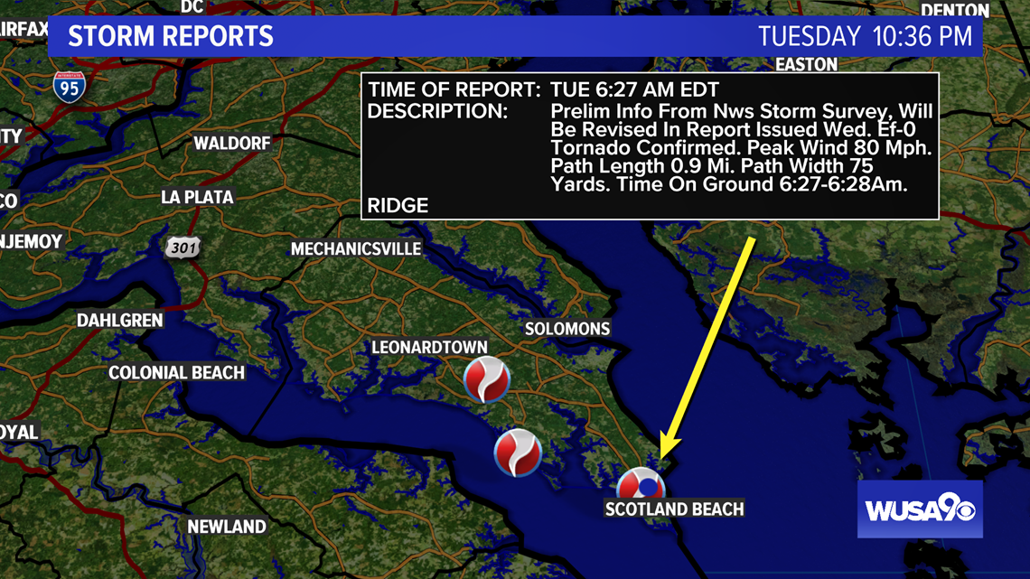
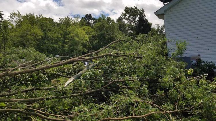
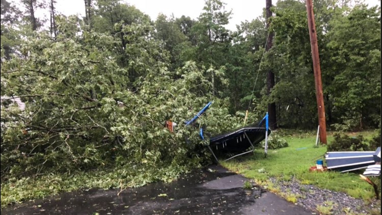
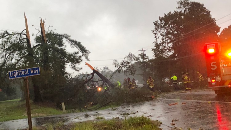
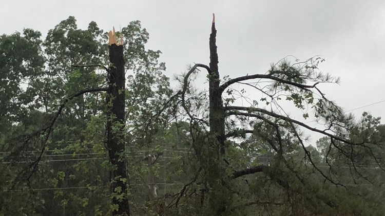
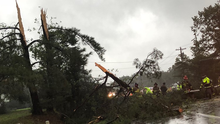
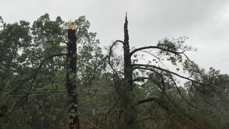
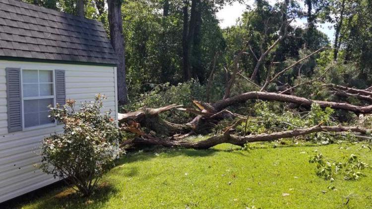
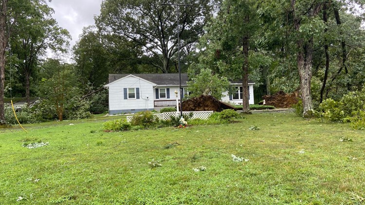
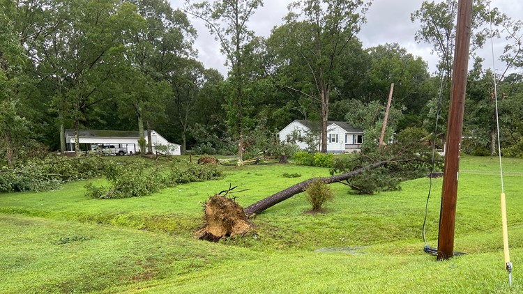
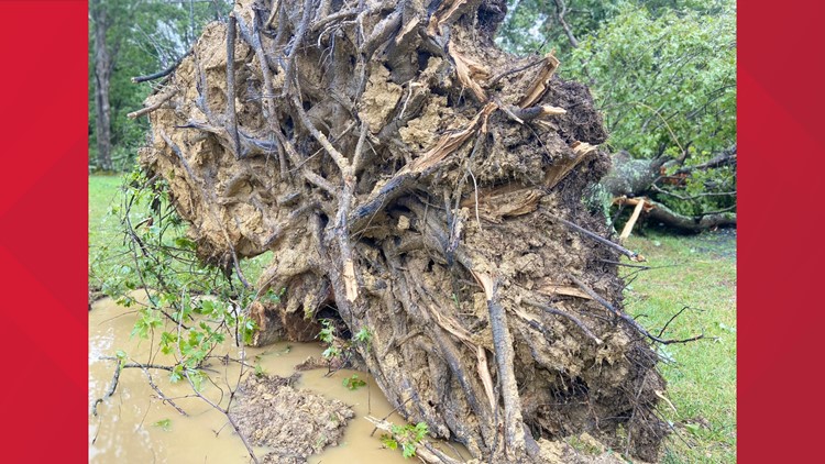
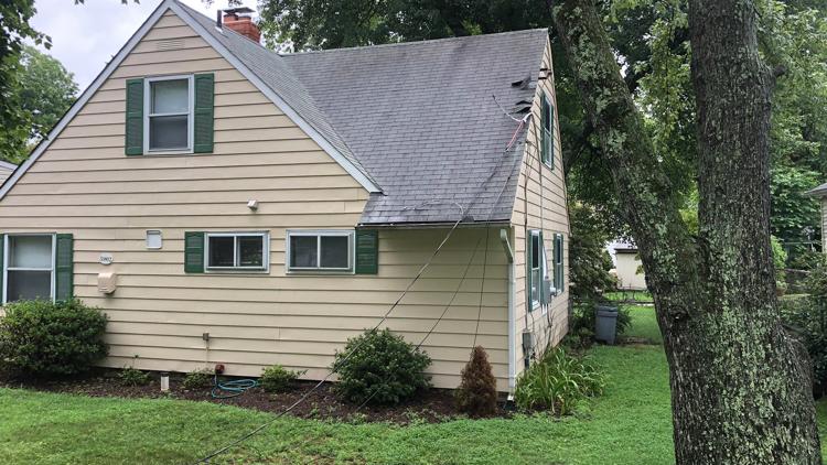
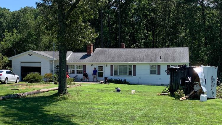
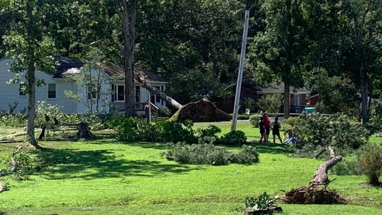
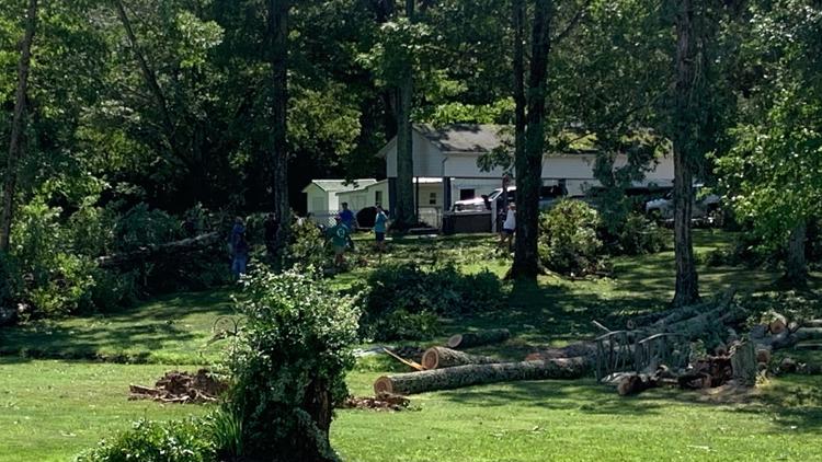
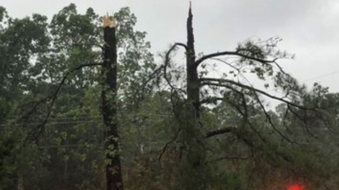
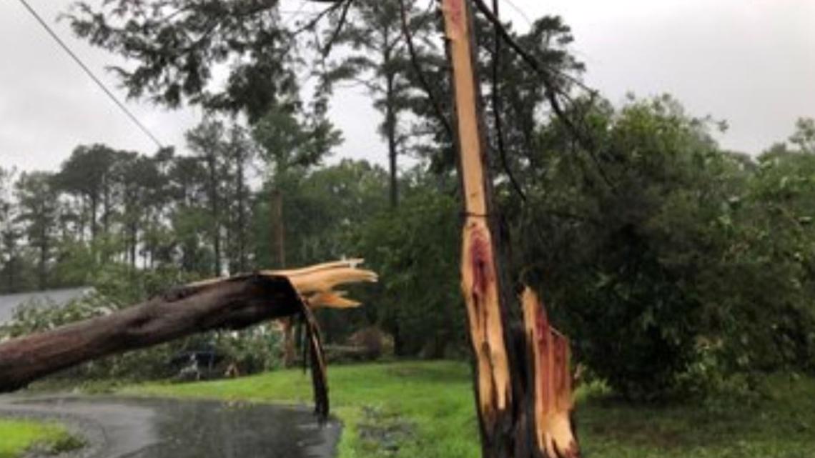
The Piney Point storm traveled to Callaway and damaged trees and homes there.

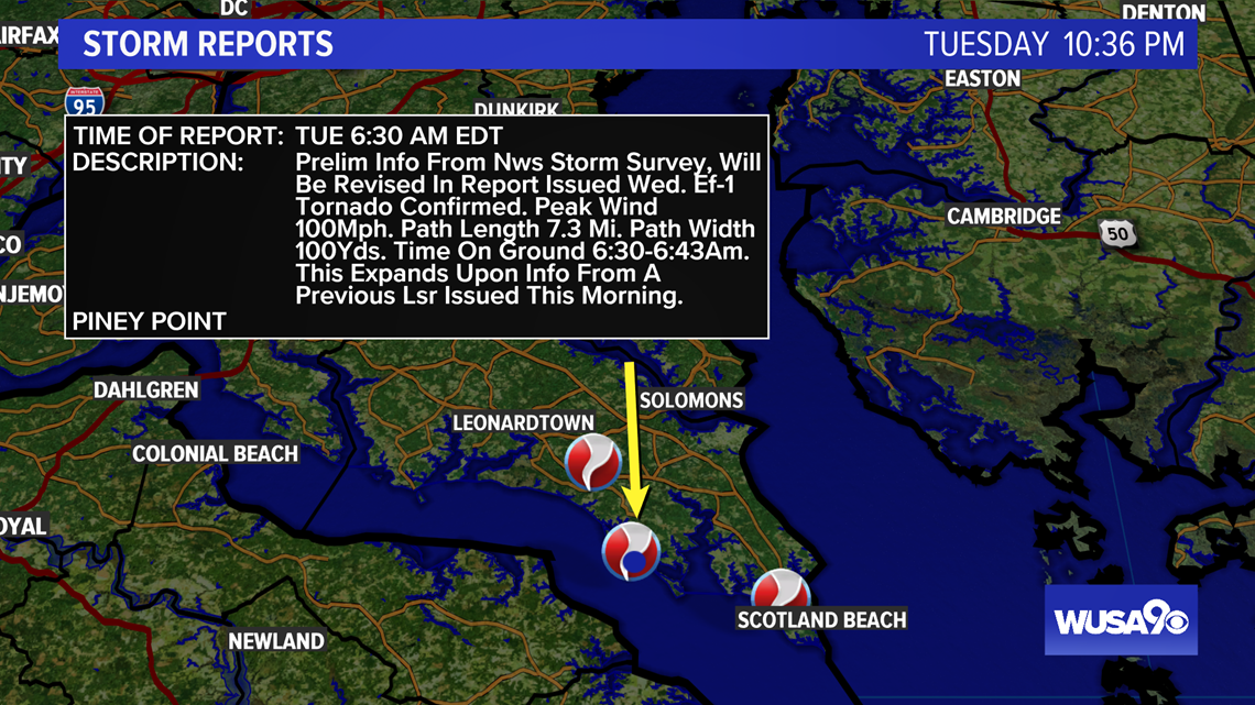

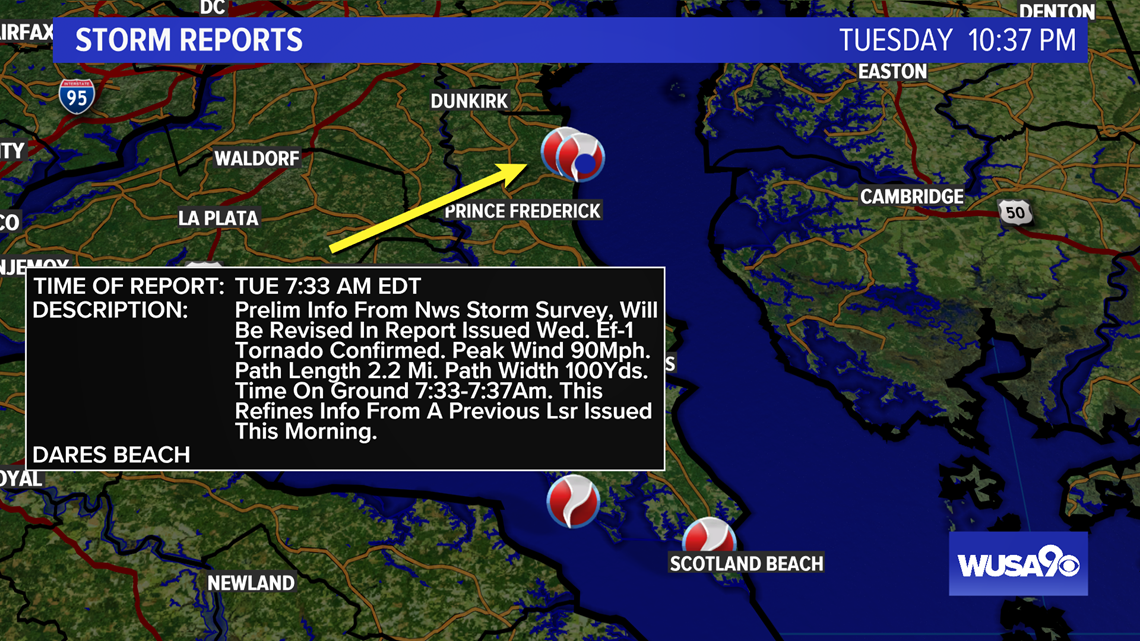
The Dares Beach tornado is the same as the Piney Point tornado.
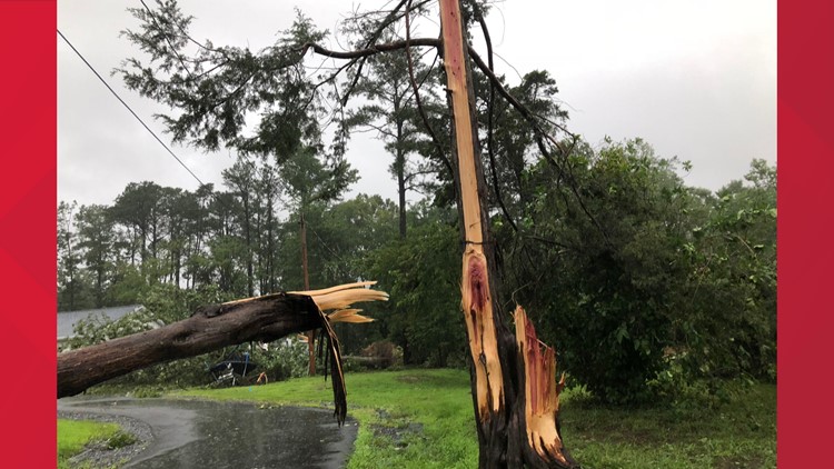
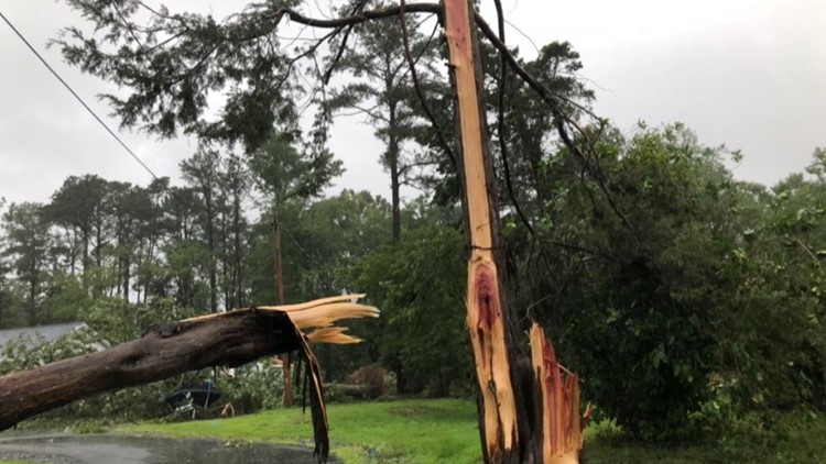
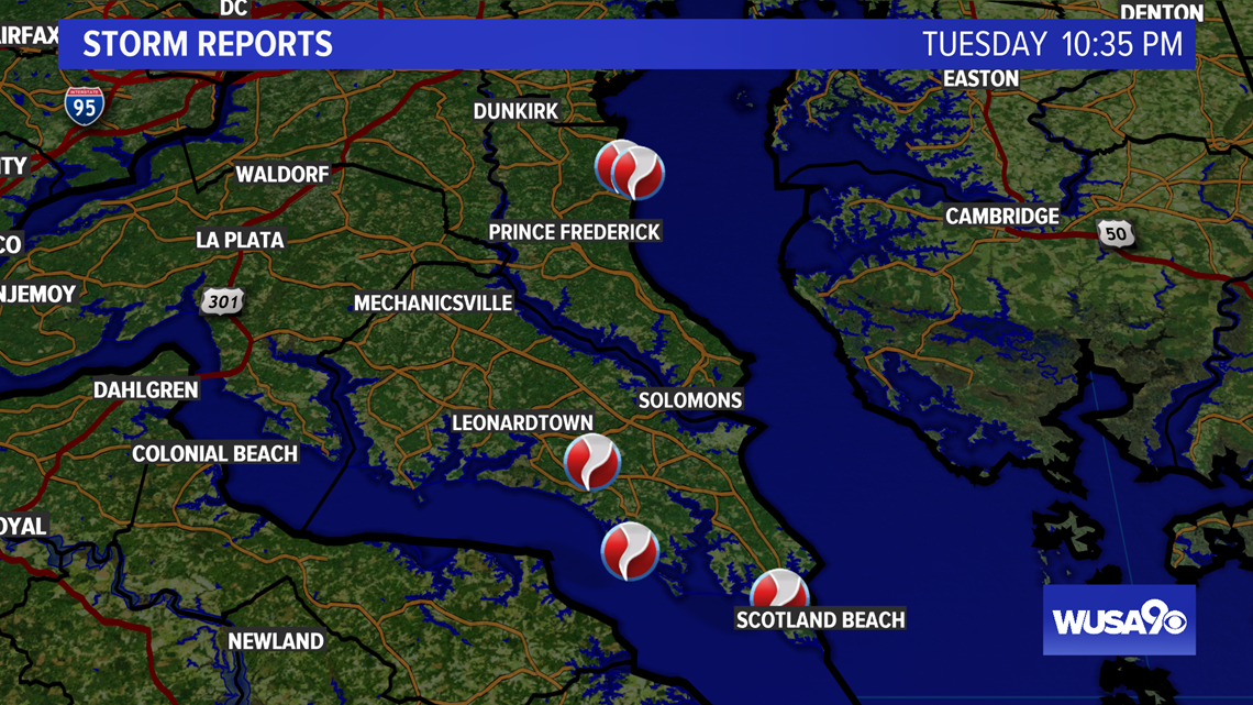
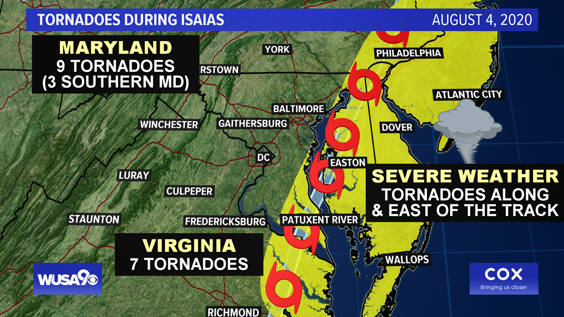
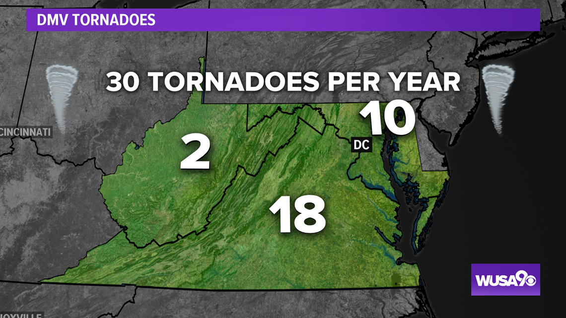
There were a total of nine tornadoes in Maryland.

Danger always lies along and east of the track.


Detailed timeline of Tropical Storm Isaias' impact on the DMV:
8:20 p.m. NWS storm surveys have concluded that 3 separate tornadoes occurred this morning in southern MD; two in St Mary's County, the other in Calvert County. A detailed report will be revised and issued Wednesday.
4:22 p.m. Leonardtown, Maryland issued a 7-day State of Emergency after a tornado spotted by an NWS trained weather watcher left significant damage in its wake.
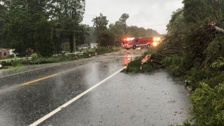
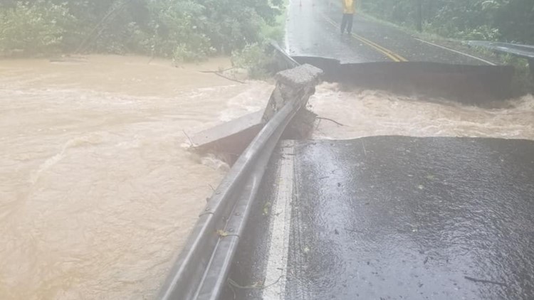
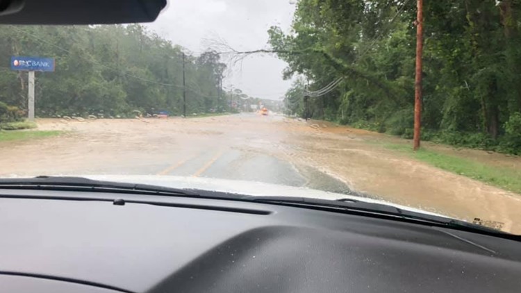
12:54 p.m. High water, flooding and downed trees shut down portions of multiple roads in St. Mary's County including:
- Mechanicsville Road between Yowaiski Mill Road and Harrow Hills Court
- Budds Creek Road between Mechanicsville Road and Chaptico Hill Lane
- New Market Turner Road between Trent Hall Road and Parlett Morgan Road
- Piney Point Road between Andover Estates Road and Denton Road
- Point Lookout Road near Flat Iron Road and between Maypole Road and Newtowne Neck Road
- Yowaiski Mill Road near Bosse Drive (no access to Country Lakes)
- Medleys Neck Road between Hunters Hill Lane and Hermitage Road
- Queen Tree Road between Oakville Road and Plowdens Way
- Willows Road between Bradley Boulevard and Greentree Drive
- New Market Turner Road between Rustin Family Lane and Delbrooke Road (police believe this closure could last days)
12:49 p.m. -- Sligo Creek Parkway is closed due to high water, Takoma Park Police said. Crews are working to remove down trees and wires in the areas of Carroll Avenue near Washington Adventist University, Flower Avenue and Carroll Avenue.
12:43 p.m. -- One person dead after a tree fell on a traveling vehicle on Three Notch Road in St. Mary's County, police said.

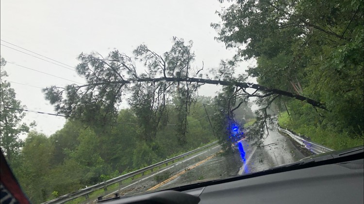
12:26 p.m. --All southbound lanes are blocked on George Washington Memorial Parkway after a tree fell just before Turkey Run Park in Fairfax County, Va., United States Park Police said.
12:13 p.m. -- The Bay Bridge reopens after a temporary closure due to high winds in the area.
12 p.m. -- Early wind gusts and rainfall totals are coming in from Isaias' impact this morning.


11:01 a.m. -- Prince Georges County Fire Department crews were called to the scene of a fallen tree on a house in the 6900 block of Hillmeade Road in Glenn Dale, Md. No one was trapped in the home and there were no injuries, officials said.
10:41 a.m. -- A utility pole is down at Flower Avenue and Chaney Drive in Takoma Park, Md. WUSA9's Laura Geller spoke to a resident who lives near the downed pole.
10:35 a.m. -- There are about 13,000 customers with power in the area of St. Mary's County and Calvert County, according to Southern Maryland Electric Cooperative.
10:33 a.m. -- No sign of flooding on Market Street in Leesburg, Virginia. The area is experiencing some rain and winds.
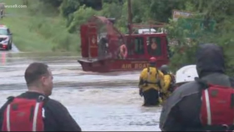
10:26 a.m. -- Emergency crews conducted a water rescue on John Rogers Boulevard and Old Marlboro Pike in Upper Marlboro, Md. The driver is expected to be okay officials tell WUSA9's Scott Broom.
10:15 a.m. -- More than 3,000 customers are without power in Northern Virginia, according to Dominion Energy.
9:55 a.m. -- High water in the area of Sligo Creek Parkway and Piney Branch in Mongtomery has prompted to turn around.
9:51 a.m. -- Firefighters tell WUSA9's Jess Arnold that a tree fell on a car trapping four critically injured people near Charlotte Hall Road in St. Mary’s County.
9:50 a.m. -- A tree fell on a traveling vehicle on West Lake Drive near Tuckerman Lane in Montgomery County, officials said. The driver was transported with non-life-threatening injuries. The tree was removed from the road by Montgomery County Fire and Rescue crews.
9:42 a.m. -- Laurel Riverfront Park closed due to high water.
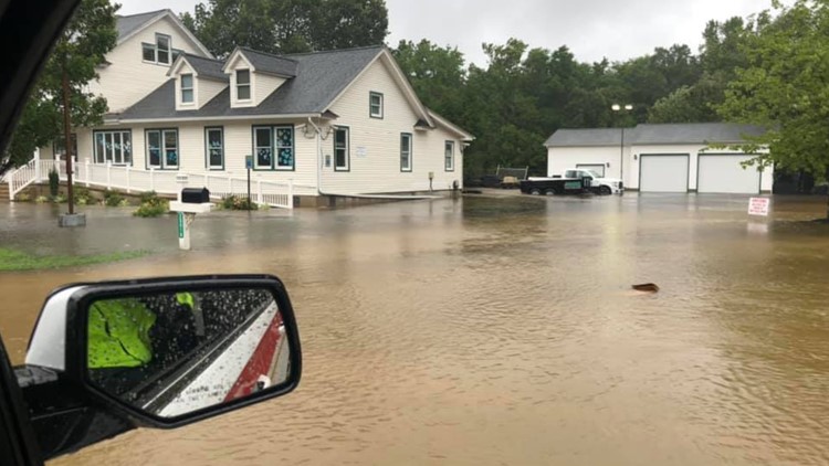
9:40 a.m. -- Several roads in St. Mary's County are flooded and trees are down. There is flooding on Mcintosh Run across Point Lookout Road, Netowne Neck Road, and Maypole Road in Leonardtown.


9:36 a.m. -- Traffic temporarily held in both directions on the Bay Bridge due to high winds, according to MDTA.
9:08 a.m. -- Heavy rain coming down in Petworth neighborhood in D.C. and flooding at Rock Creek.
9:05 a.m. -- Police are blocking off King Street at Waterfront in Old Town Alexandria.
8:38 a.m.-- Flooding on Route 5 in Great Mills, Md. in St. Mary's County. A nearby creek overflowed with rainwater and spilled over to the roadway.

8:37 a.m. -- Flood Warnings issued in Montgomery County, D.C., and Prince George's County until 2:30 p.m.

8:32 a.m. -- Heavy downpour in Bowie, Md. during Prince George's County issued Flash Flood Warning.

8:30 a.m.-- Flooding spotted on Long Beach Drive in Calvert County.

7:52 a.m.-- Tornado warning canceled in Prince George's County.
7:43 a.m. -- Tornado Warning issued in Prince George's County until 8:15 a.m.
7:36 a.m. -- Flash Flood Warnings issued in Prince George's, Calvert, Charles and Anne Arundel counties until 11 a.m.
7:26 a.m. -- Several roads are flooded in North Beach, Md. in Calvert County due to heavy downpour.
7:19: a.m. -- Tornado Warning issued in Anne Arundel County and a new warning is issued in Calvert County until 7:45 a.m. There is a threat of hail in the area.
7:01 a.m.-- Flash Flood Warning issued for southern Maryland until 11 a.m.
7 a.m. -- Tornado spotted over Leonardtown, Md. in St. Mary's County, according to National Weather Service trained spotter. The tornado moved northwest at 45 mph.


6:45 a.m. -- Tornado Warnings issued in Calvert County and St. Mary's County until 7:15 a.m. A well-defined, possibly tornadic circulation is moving through your area now too.
6:36 a.m. -- No Tornado Warnings issued in D.C., Maryland, and Virginia.
6:32 a.m. -- Tornado Warnings canceled in St. Mary's and Charles counties.
6:24 a.m. -- Bay Bridge wind warnings in effect, according to MDTA.
5:30 a.m. -- New Tornado Warnings have been issued in St. Mary's and Charles counties until 6:45 a.m.
5:57 a.m. -- Tornado Warning issued in the Northern Neck of Virginia until 6:30 a.m. This includes Westmoreland County.
5:28 a.m. -- National Oceanic and Atmospheric Administration (NOAA) says "Potentially life-threatening flash flooding will be possible" in the next few hours in the DMV area. Impacted areas will include the major metropolitan areas of Washington D.C, Baltimore and Philadelphia.
5:12 a.m. -- Solomons, Md. in Calvert County near St. Mary's County is seeing heavy downpour and some areas are seeing rain totals of more than 6 inches. Winds are also beginning to pick up in the area.
4:45 a.m.-- Tornado Warning issued for St. Mary's County and Charles County, Md. until 5:15 a.m.
4:44 a.m. -- Coastal Flood Warning issued in St. Mary's County until 5:15 a.m. Tuesday to 3:00 a.m. Wednesday.
4:30 a.m. -- Tornado Warning expired for St. Mary's County
4:03 a.m. -- Hurricane Isaias has been downgraded to a tropical storm.
3:51 a.m. -- Car overturns on the Inner Loop of the Beltway at Baltimore/Washington Parkway. Rescue crews were called to the scene.
2:51 a.m.-- Red Weather Alert issued for the DMV area