

LEONARDTOWN, Md. — The National Weather Service spotted a tornado in Leonardtown in St. Mary's County, Maryland, early Tuesday morning.
Leonardtown, Maryland has issued a 7-day State of Emergency after a tornado, spotted by an NWS trained weather watcher, caused significant damage to the area.
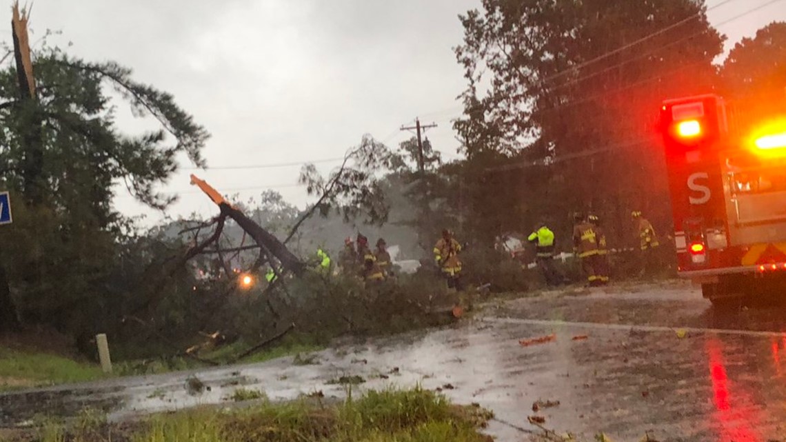
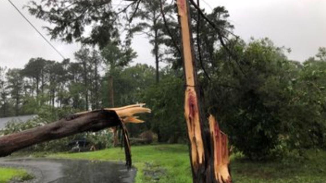
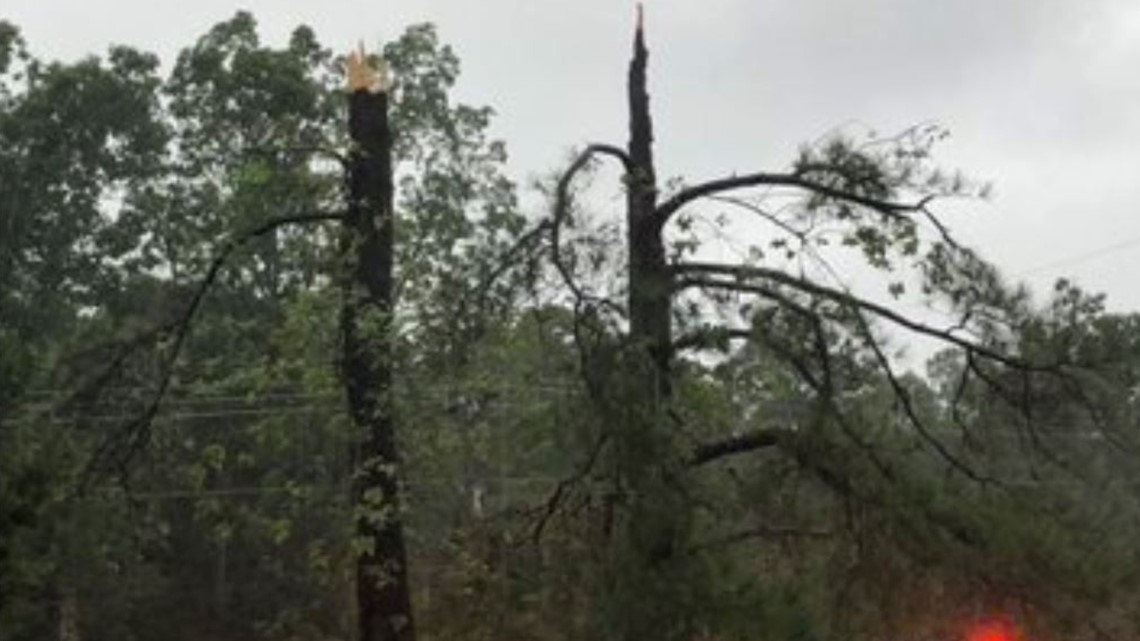
A professional weather spotter reported the tornado around 6:45 a.m. The tornado touched down on MD 5 next to Winter Sheet Metal south of Leonardtown, with winds around 70 mph.
Photos from the scene showed fire crews on the scene where trees were damaged and knocked down by the high winds. The tornado also caused damage to a house, the National Weather Service reported.
There were no reports of injuries due to the tornado.
If you are in the path of a tornado or tornado warning, take cover immediately and get to low ground.

WUSA9's Jess Arnold spoke with the owner of an RV camper, Evelyn Bean, who said her camper flipped three times after a tornado hit her house in St. Mary's County.
The St. Mary's County Sheriff's Department is also investigating a fatal crash where a large tree fell on top of a moving car in Mechanicsville, killing one person trapped inside the car.
Police said the incident happened near Charlotte Hall Road off Route 5, and firefighters were working for almost two hours to clear the road and free the trapped person from the car.

High water, flooding and downed trees shut down multiple other roads including:
- Mechanicsville Road between Yowaiski Mill Road and Harrow Hills Court
- Budds Creek Road between Mechanicsville Road and Chaptico Hill Lane
- New Market Turner Road between Trent Hall Road and Parlett Morgan Road
- Piney Point Road between Andover Estates Road and Denton Road
- Point Lookout Road near Flat Iron Road and between Maypole Road and Newtowne Neck Road
- Yowaiski Mill Road near Bosse Drive (no access to Country Lakes)
- Medleys Neck Road between Hunters Hill Lane and Hermitage Road
- Queen Tree Road between Oakville Road and Plowdens Way
- Willows Road between Bradley Boulevard and Greentree Drive
- New Market Turner Road between Rustin Family Lane and Delbrooke Road (police believe this closure could last days)
Several tornado watches and warnings were issued in the morning hours as Isaias moved through the DMV. Most of those warnings were as a result of radar-indicated tornadoes. The Leonardtown tornado is the first reported tornado that caused damage.


Elsewhere in St. Mary's County, the storm brought an estimated nine inches of rain by 9 a.m.
That rain brought power outages as well as flooded roads.
By 10:30 a.m. an estimated 13,000 customers were without power in St. Mary's and Calvert Counties according to Southern Maryland Electric Cooperative.
St. Mary's Department of Emergency Services shared photos of washed out roads in the area Tuesday morning, warning people to stay home if possible.
Tropical Storm Isaias hammered the DMV Tuesday morning. The storm brought heavy rain, damaging winds, flooding and multiple tornado warnings throughout Tuesday morning.
A coastal flood warning was in effect for other areas of our region.
Isaias made landfall overnight Monday in North and South Carolina as a Category 1 hurricane. It was downgraded to a tropical storm around 4 a.m. Tuesday morning.